Welcome to a concise guide to all our content! We have almost 200 articles posted, and we hope this Table of Contents will help you find what you are looking for.
Road Journeys
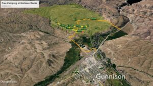
This is a comprehensive guide to free dispersed camping at Hartman Rocks near Gunnison in Colorado. If you are traveling ...

If you’ve ever planned a road trip and thought, “Surely there’s a better way to do this,” congratulations—you’re already ahead ...

A Pilgrimage Through the Blue Ridge, the Alleghenies, and the Wild Edges of the Commonwealth From the moss-draped hollows of ...
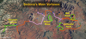
Introduction to Sedona's Vortexes Using my Sedona Vortex Guide, you can visit the 4 main vortexes in one action-packed day! ...
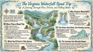
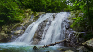
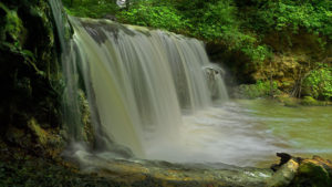
Virginia is quietly one of the most waterfall-rich states on the East Coast. Tucked into the folds of the Blue ...
Panther Falls VA is a very popular local swimming hole on the Pedlar River near Buena Vista. The waterfall is ...
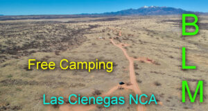
Free Camping in Las Cienegas near Sonoita and Tucson, AZ Welcome to our guide for FREE camping on BLM land ...
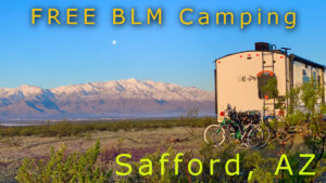
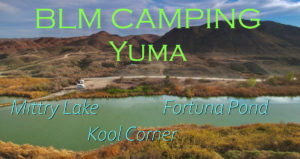
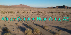
Free Camping near Safford and Hot Well Dunes Recreation Area Welcome to our guide for FREE camping on BLM land ...
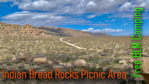
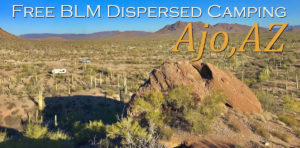
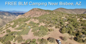
Free Camping at Indian Bread Rocks near Bowie, AZ Welcome to our guide for FREE camping on BLM land south ...
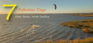
Introduction In this wonderful 7-day itinerary, we visit the Outer Banks of North Carolina while driving the Outer Banks National ...
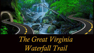
Updated for 2024 The Great Virginia Waterfall Trail One Amazing Road Trip to ALL the Waterfalls in Virginia The 1373-mile ...
The Falls of Whiteoak Canyon is Virginia's TOP WATERFALL TRAIL. If you have only one day to see as many ...
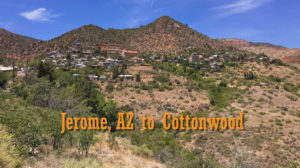
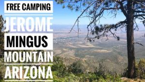
America's Most Scenic Drives - Driving 89A in Arizona between the old mining town Jerome and Old Town Cottonwood via ...
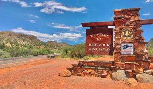
America's Most Scenic Drives - Driving the Red Rock Scenic Byway (SR-179) from I-17 to Uptown Sedona. Named in 2005, ...

14-Day Itinerary Introduction In 2 weeks on the road, you can truly experience the best of the Blue Ridge Parkway ...

The mountains of Virginia can be dangerous, and a safety kit is essential for adventurers looking for waterfalls! This is ...
Folly Mills Falls is one of Staunton's best-kept secrets! The pretty Folly Mills Falls is just 0.1 miles from the ...
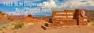
Updated for 2024 This is a complete guide to FREE dispersed camping on BLM land between Torrey and Capitol Reef ...
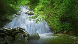
Crabtree Falls has the highest cascading vertical drop east of the Mississippi! At 1200 feet it is impossible to photograph ...
When the Stony Creek flows hard, these Falls are smokin', especially the Falls at Lower Shamokin (covered in another post)! ...
Inner Journeys

The most violent storm passes quickly. The hardest rain rarely lasts all day. Even Heaven and Earth cannot sustain extreme ...

The tallest tree snaps in the storm; the bamboo bends and survives. The river that yields to every rock eventually ...
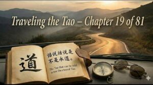
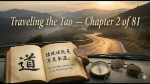
Traveling the Tao – Chapter 21 Explained: Following the Invisible Trail – The Tao’s Hidden Signature

The best trails in the wilderness are often unmarked – a subtle indentation in the grass, a bent branch, a ...

At the festival, everyone rushes toward the bright lights, the music, the feast. But the sage slips away to a ...
Every overpacked suitcase contains items you were told you “might need” – extra shoes, emergency gadgets, clothes for every weather ...

When the highways are well‑marked, and the routes are clear, no one talks about “how to find the way.” But ...

The best travel companions are the ones you barely notice – until they’re gone. They don’t announce their expertise, don’t ...

Every road, no matter how far it stretches, eventually turns back toward home. Every traveler, no matter how restless, eventually ...

The most experienced travelers rarely announce themselves. They move with the hesitance of someone crossing a frozen river, the caution ...

The best roads are not always marked on any map. The deepest calls to adventure are not shouted—they are felt ...

Every traveler knows the fear of losing face: the reservation that falls through, the photo that didn’t turn out, the ...
Introduction In the sacred texts of the Hindu and Buddhist traditions, three symbols often appear together: the wish-fulfilling jewel (Cintamani), ...
Executive Summary Moldavite and Saffordite are often grouped in metaphysical circles, but their value is easier to understand when stripped ...
Executive Summary For decades, Saffordite has captivated collectors and spiritual seekers alike, marketed as the enigmatic "Cintamani Stone" with origins ...
Disclaimer: What follows is a description of our personal beliefs, spiritual experiences, and opinions — not scientific facts. We are ...

The road is full of dazzling sights: neon signs promising adventure, guidebooks shouting “must-see,” souvenir markets tempting with rare treasures ...
The hub of a wheel is just empty space—yet without it, the wagon cannot roll. The hollow of a cup ...

The master traveler doesn't just move through the world—they carry themselves with the wholeness of an infant, the clarity of ...

The most memorable journeys aren't the ones where you packed everything, saw everything, and did everything. They're the ones where ...
Water doesn't fight its way across the continent. It flows—around mountains, through valleys, into the lowest places—and in its yielding, ...

The longest-lasting roads weren't built to impress anyone. The most unforgettable journeys aren't the ones you take for yourself alone ...
Every great journey has a silent, guiding force—the hidden spring that feeds the river, the calm valley that channels the ...

Do you wonder how the Tao Te Ching acts as both a spiritual compass and a deepening mirror for the ...

Think you've reached the end? Discover the beautiful truth of the Taoist spiral. Learn how the return from authentic power ...

Tired of forcing influence? Discover DE, Taoism's concept of authentic power that arises naturally from alignment. Learn how living by ...

Ready to transform stress into strength? Discover Neidan, Taoism's internal alchemy for modern life. Learn how to use the 5 ...

Discover how Qigong is the essential bridge between effortless action (Wu Wei) and inner transformation. Learn a simple 5-element daily ...

Tired of forcing outcomes? Discover Wu Wei, Taoism's secret to effortless flow. Learn how to sync your actions with the ...

Ethics feeling abstract? Discover the Taoist Three Treasures—Frugality, Humility, Compassion—as practical energy tools. Learn how to weave Jian, Humility, and ...

The open road does not play favorites—it offers its expanse to the hurried commuter and the meandering wanderer alike. In ...

Burned out by self-care? Discover Yang Sheng, Taoism's 5,000-year-old system for sustainable energy. Learn how to sync your daily habits ...

Discover Pu, the ancient Taoist secret to effortless living. Learn how to use your existing daily routine—no extra time or ...

Tired of linear self-improvement? Discover the Taoist Spiral of Harmony, a map for effortless living. Learn how to align your ...
A seasoned traveler knows the value of empty space. It's the hollow trunk that holds the gear, the quiet moment ...

The most seasoned travelers know a secret: a lighter pack leads to a farther journey. Tao Te Ching Chapter 3 ...
On a long road, the stillness of a valley is defined by the climb that preceded it, and the joy ...
The map is not the territory. This ancient principle, central to both philosophy and modern systems thinking, finds its earliest ...

As the year draws to a close, many of us feel it — a subtle pull to pause, reflect, and ...
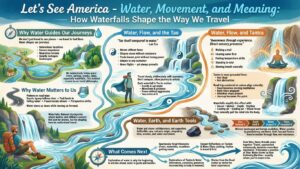
Why Water Guides Our Journeys At Let’s See America, we don’t just travel to see places — we travel to ...
ASMR
No posts found.
Earth Tools
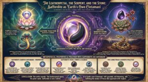
The Leatherpetal, the Serpent, and the Stone: Saffordite as Earth’s Own Cintamani
Introduction In the sacred texts of the Hindu and Buddhist traditions, three symbols often appear together: the wish-fulfilling jewel (Cintamani), ...
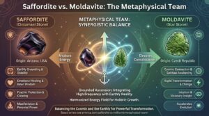
Moldavite and Saffordite – The Cosmic Catalyst and the Terrestrial Anchor
Executive Summary Moldavite and Saffordite are often grouped in metaphysical circles, but their value is easier to understand when stripped ...
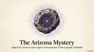
The Arizona Mystery: Why Saffordite is One of the World’s Most Valuable Stones
Executive Summary For decades, Saffordite has captivated collectors and spiritual seekers alike, marketed as the enigmatic "Cintamani Stone" with origins ...
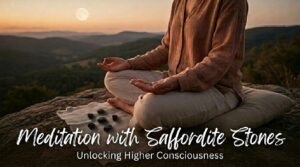
Meditation with Saffordite Stones – Unlocking Higher Consciousness
Disclaimer: What follows is a description of our personal beliefs, spiritual experiences, and opinions — not scientific facts. We are ...
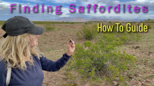
Where to Find Saffordite in Arizona
A Guide for Saffordite Rock Hunters Executive Summary — Where to Find Saffordite Rocks in Arizona Rockhounding for Saffordite in ...

Saffordite and the Nine Sacred Cycle of Numbers
Executive Summary Saffordite and the 9 Sacred Cycle of Numbers In a world overwhelmed by constant digital noise and stimulation, ...
Field Notes
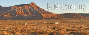
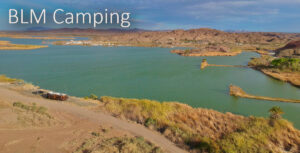
Free BLM Camping in America
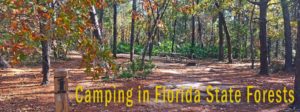
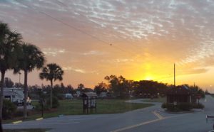
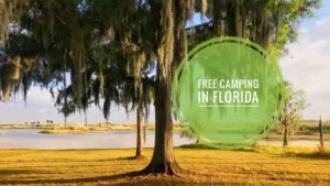
Florida – Free Camping


Thoughts from Melinda
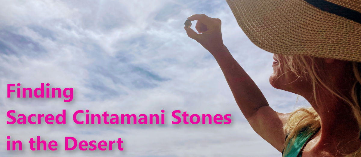
Introduction to Cintamani Stones I first read about the Cintamani Stone several years ago and instinctively knew this Stone was ...
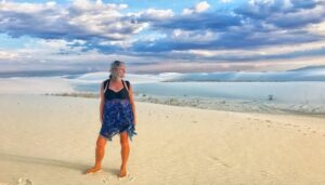
White Sands National Park ~ A natural wonder unlike any on Earth Introduction I have been to many National Parks ...

Are you Creating Your Life...or is Your Life Creating You? - Mel J From Soccer Mom to Minimalist Nomad in ...

Peace is on the minds of many people throughout the world right now. Last week I unexpectedly found peace in ...

I snapped this beauty from my car window in rural Wyoming. There were a few others, but too far away ...

Zen rocks in a cascading stream I have always found the sound of water so soothing to the soul. Whether ...
Our RV


Arizona – Free Camping


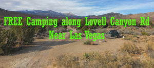
Nevada – Free Camping
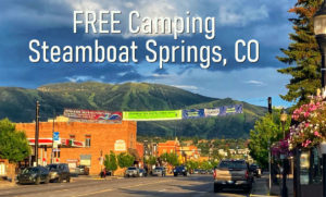
Colorado – Free Camping
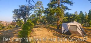
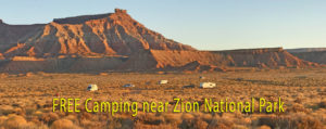
Utah – Free Camping
Texas – Free Camping
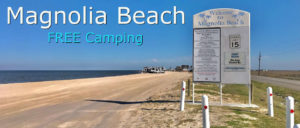
Updated for 2024 Magnolia Beach in Texas is one of the most amazing free camping areas in all of America ...