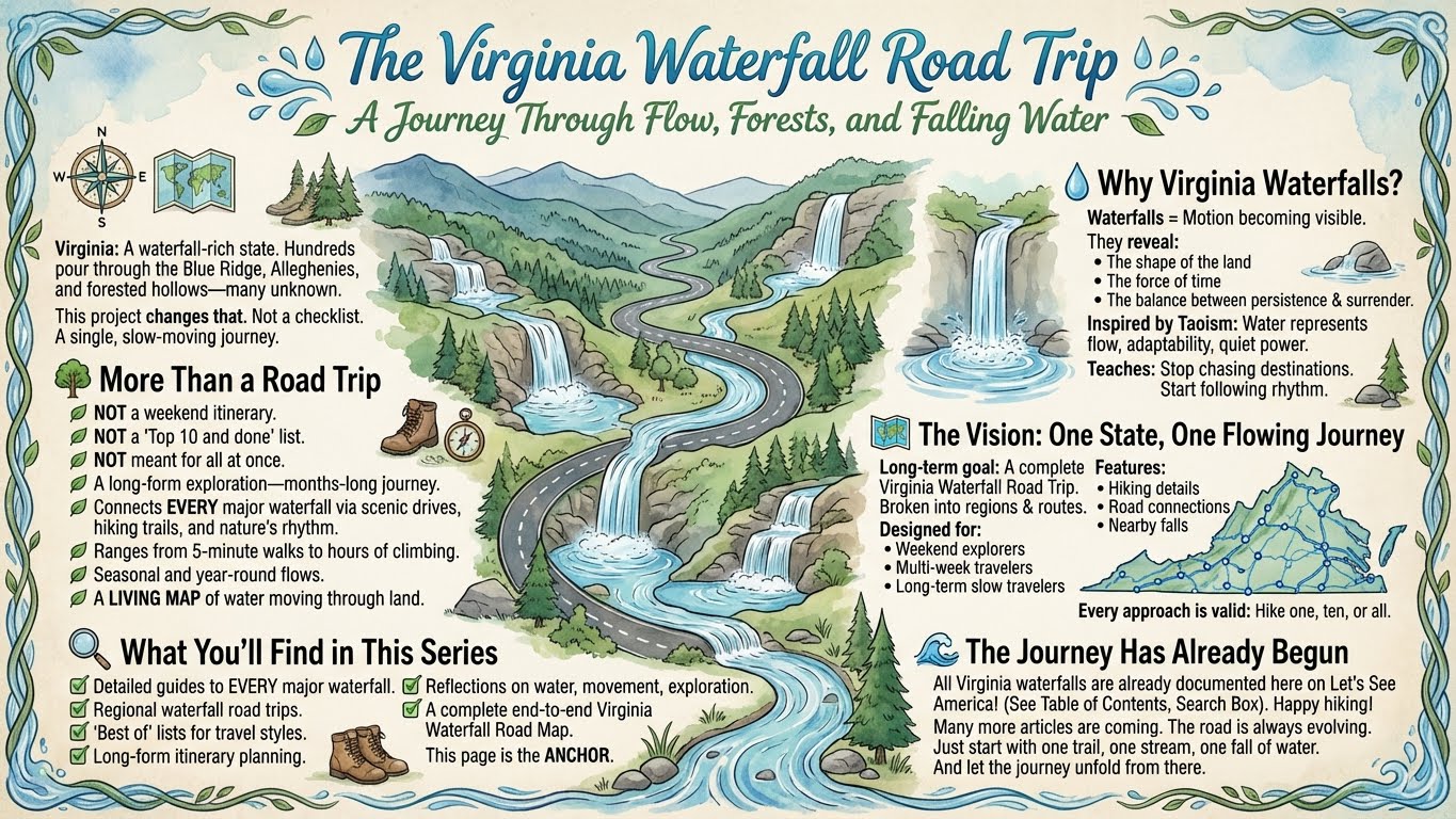
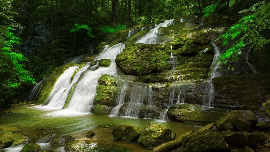
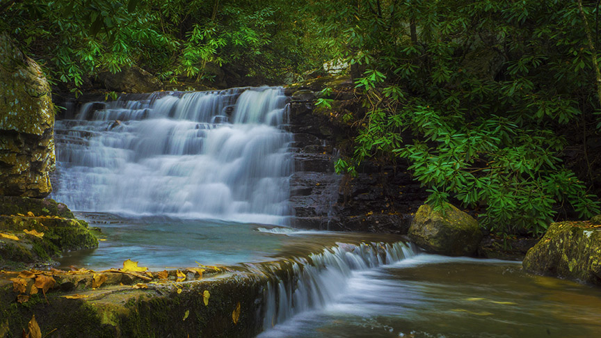
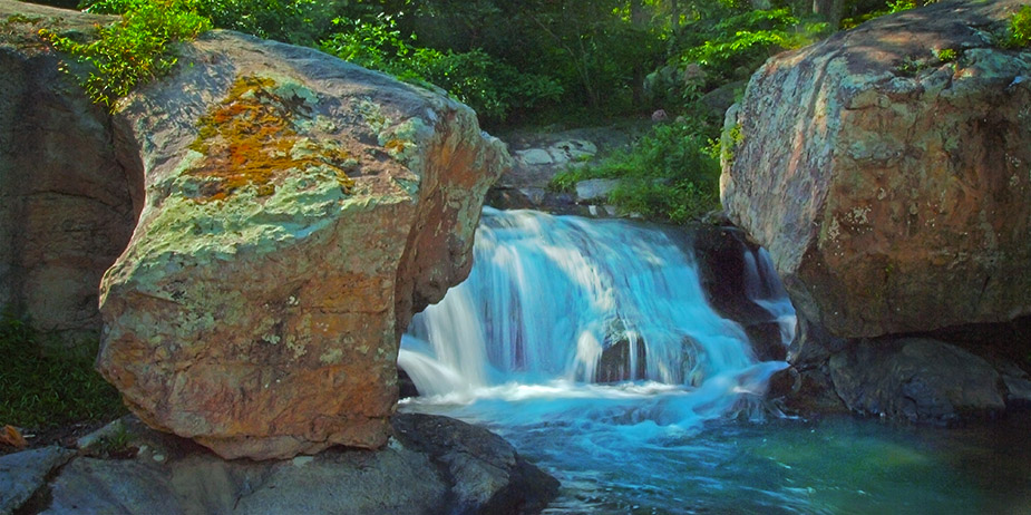
Virginia is quietly one of the most waterfall-rich states on the East Coast.
Tucked into the folds of the Blue Ridge Mountains, scattered across the Alleghenies, and hidden in forested hollows from Shenandoah to the Tennessee border, hundreds of waterfalls pour through the state — many of them unknown, unnamed, or rarely visited.
This project exists to change that.
Not by rushing through them.
Not by turning them into a checklist.
But by weaving them together into a single, slow-moving journey.
Welcome to The Virginia Waterfall Road Trip.
🌿 More Than a Road Trip
This is not a weekend itinerary.
It’s not a “Top 10 and done” list.
And it’s not something meant to be completed all at once.
This is a long-form exploration — a months-long journey that connects every major waterfall in Virginia through scenic drives, hiking trails, and the quiet rhythm of nature.
Some waterfalls are reached in five minutes.
Others take hours of climbing.
Some roar in spring and vanish by August.
Others flow year-round, patient and constant.
Together, they form something larger:
A living map of water moving through land.
💧 Why Virginia Waterfalls?
Waterfalls are where motion becomes visible.
They reveal:
- The shape of the land
- The force of time
- The balance between persistence and surrender
In many spiritual traditions — especially Taoism — water represents flow, adaptability, and quiet power. It doesn’t resist obstacles; it moves around them. It doesn’t rush, yet it shapes mountains.
A long waterfall journey teaches the same lesson.
You stop chasing destinations.
You start following rhythm.
🗺️ The Vision: One State, One Flowing Journey
The long-term goal of this project is to create:
- A complete Virginia Waterfall Road Trip
- Broken into logical regions and routes
- Designed for:
- Weekend explorers
- Multi-week travelers
- Long-term slow travelers
- With:
- Hiking details
- Road connections
- Nearby waterfalls
- Seasonal considerations
- Philosophical reflections along the way
Some people may hike one waterfall.
Others may chase ten.
A few may attempt them all.
Every approach is valid.
🔍 What You’ll Find in This Series
Over time, this project will expand to include:
- ✅ Detailed guides to every accessible major waterfall in Virginia
- ✅ Regional waterfall road trips
- ✅ “Best of” lists for different travel styles
- ✅ Long-form itinerary planning
- ✅ Reflections on water, movement, and exploration
- ✅ A complete end-to-end Virginia Waterfall Road Map
This page serves as the anchor — the place where it all comes together.
🌊 The Journey Has Already Begun
All the waterfalls in Virginia are already documented in posts right here on Let’s See America! You can find them in our Table of Contents and from the Search Box.
For each waterfall, you will find:
- Beautiful photos
- Driving Directions
- 3D Trail Map
- Trail Notes
- Trail Profile
- Google Map
We also created a Google Map with accurate locations of each Virginia waterfall.
Many more articles are coming.
And the road itself is always evolving.
You don’t need to see them all at once.
Just start with one trail.
One stream.
One fall of water.
And let the journey unfold from there.