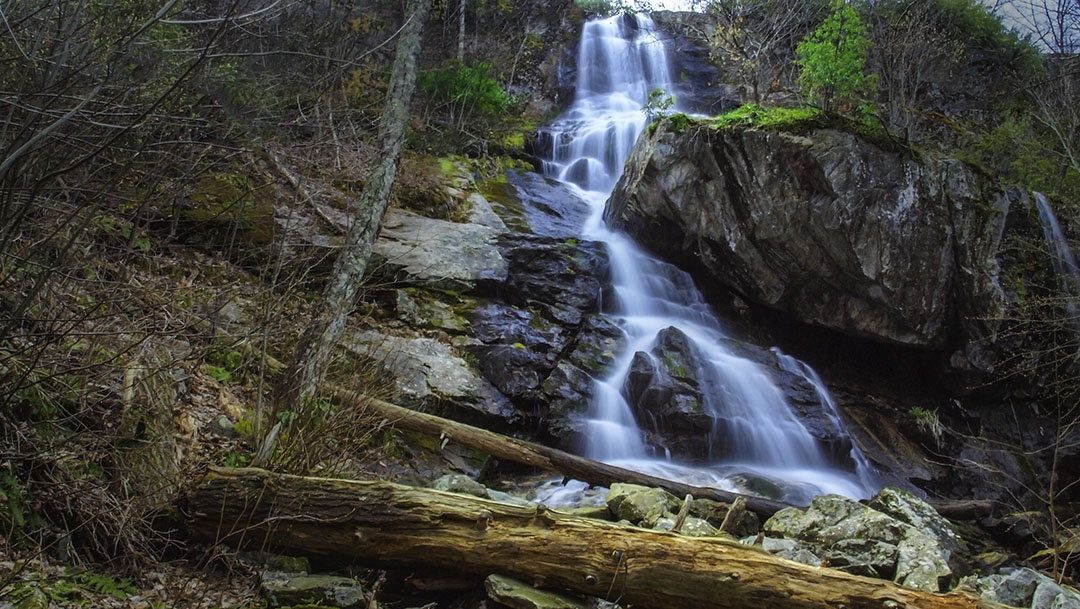
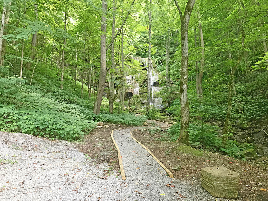
Tank Hollow Falls is a very scenic 60-foot waterfall in the town of Cleveland in Russell County, Virginia.
What makes these Falls special is the fact that one can park very close to the base, making it one of the most accessible waterfalls in Virginia.
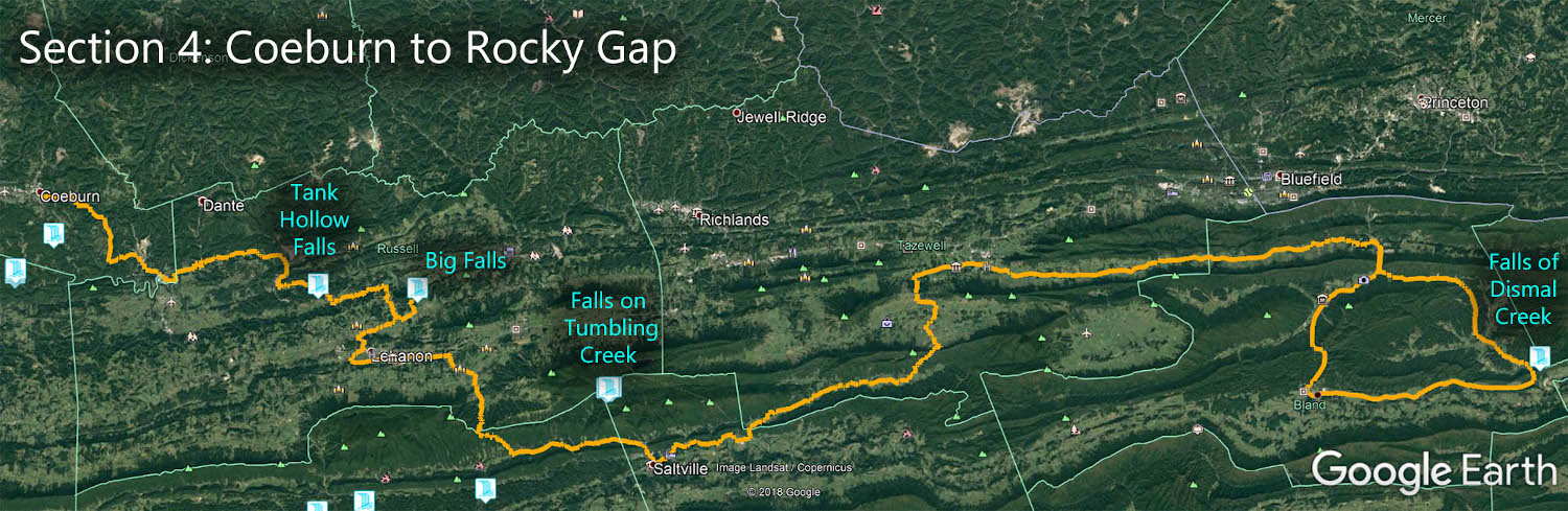
The Great Virginia Waterfall Trail
Tank Hollow Falls is in Section 4 of the Great Virginia Waterfall Trail which travels 165 miles from Coeburn to Rocky Gap.
Directions
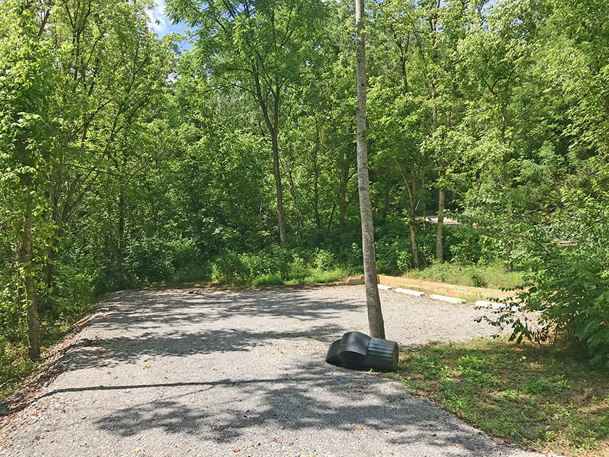
From Cleveland St, turn SW to 4th Street then left to Tank Hollow Road. Drive downhill to the parking area in front of the Falls. There is a short gravel trail to the Falls.
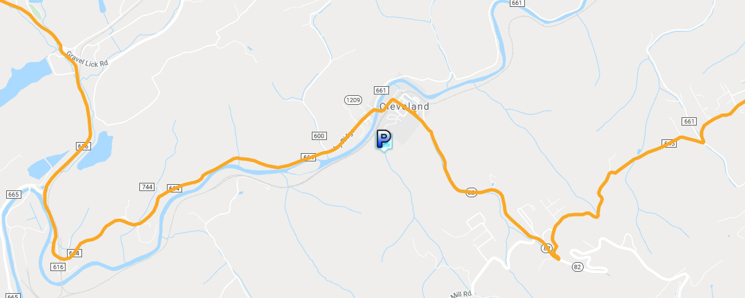
Trail Map

Google Map of Virginia Waterfalls
Tank Hollow Falls is near Cleveland on this Virginia Waterfalls map by Eben Schoeman.