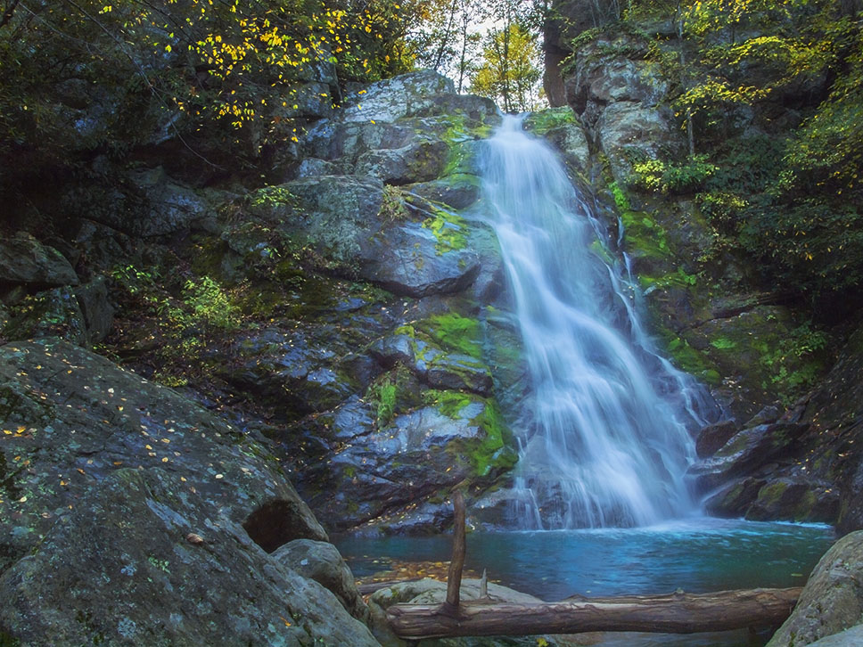
Stiles Falls was named after Randolph Stiles, who sadly lost his life near the Falls during a Sunday School picnic.
It is a hidden gem waterfall in Shawsville, Virginia, tucked away on the scenic property of Camp Alta Mons. This peaceful 40-foot cascade sits at the end of a moderate 3.3-mile round-trip hike that’s perfect for hikers, families, and outdoor adventurers exploring the Virginia Blue Ridge Mountains.
Whether you’re planning a quick day trip from Roanoke or building a waterfall tour of the region, this guide covers everything you need to know — from trail directions and difficulty to what to bring and the best times to visit.
📍 Where Is Stiles Falls?
Parking Location: 37.0967, -80.2506
Stiles Falls is located near Shawsville in Montgomery County, Virginia, on the grounds of Alta Mons Camp & Retreat Center. The trailhead is accessible from Crockett Springs Road, located just off the main road leading into the camp.
Visitors are welcome to hike from dawn until dusk when camp sessions are not in session. It’s a short drive from Roanoke, Christiansburg, and Blacksburg, making it a great half-day outdoor adventure.
Directions
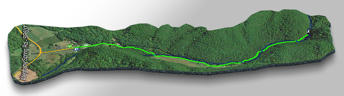
Make your way to Alleghany Spring Road (SR-637) and look for Camp Alta Mons on the south side of the road. Drive up to the office on the left and park in the small lot on the right. DO NOT enter the gate with your vehicle.
Do check in with the office as a courtesy and sign your name on the visitor sheet next to the gate.
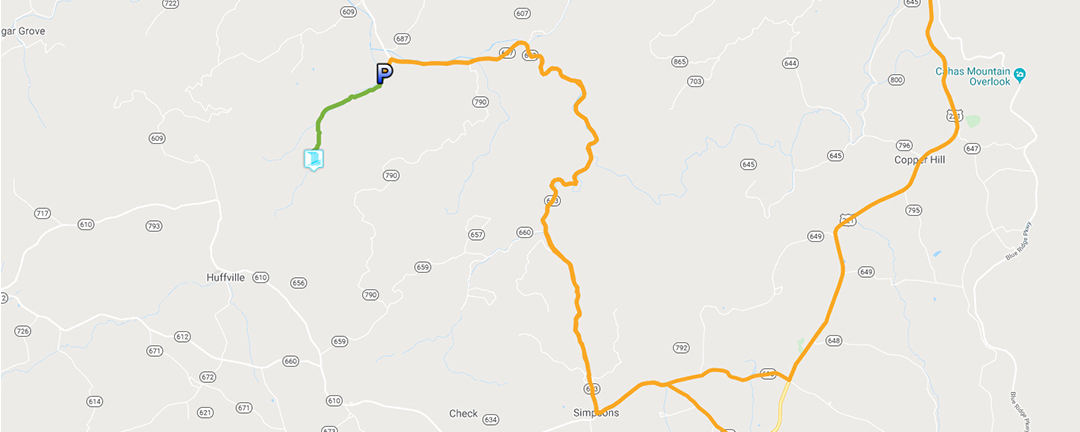
Look for signs pointing to Stiles Falls and follow the trail markers (white blazes) as you make your way toward the waterfall.
🥾 Trail Overview and Hiking Details
- Trail Type: Out & Back
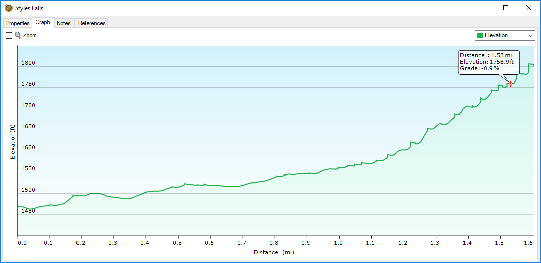
- Distance: ~3.3 miles round trip
- Difficulty: Moderate – gets steeper near the Falls
- Elevation Gain: ~350 ft
- Time: ~2 hours
- Dogs: Allowed on leash
- Best Time: Spring and Fall
The trail begins on a gravel road past the camp entrance and soon transitions into a wooded path that follows Purgatory Creek upstream. Expect three creek crossings and some rocky terrain near the waterfall, so good footwear is recommended.
3D Trail Map – Stiles Falls
🌊 What the Trail Is Like
The first part of the route follows a wide dirt and gravel path through the camp property, passing camp cabins, a pool, and a small pond. The trail becomes more natural as you approach the creek, with typical forest terrain — roots, rocks, and occasional muddy patches.
Creek Crossings:
You’ll cross the creek three times as you follow the trail upstream. Shoes that can get wet or provide a good grip are helpful.
Final Approach:
Near the waterfall, the trail is steeper and becomes rockier. A short rock scramble leads you to the base of the falls — a beautiful spot to relax, take photos, or enjoy a picnic.
🌸 Best Time to Visit Bent Mountain Falls
Spring (March–May)
✅ Best water flow
✅ Wildflowers
⚠️ Muddy trails possible
Summer (June–August)
✅ Lush greenery
⚠️ Humid, lower water levels
Fall (September–November)
🍁 Stunning foliage
🍂 Cooler temperatures
📸 Best photography season
Winter
⚠️ Trails may be icy
⚠️ Trail may be closed or have limited access after snow
👉 For the best experience, visit in late spring or mid-fall.
Water levels vary with rainfall, so after wet weather, the falls and creek crossings can be more dramatic and scenic. Always use caution on slick rocks.
🎒 What to Bring
✔ Sturdy hiking shoes – may get wet in creek crossings
✔ Water & snacks
✔ Bug spray (in warm months)
✔ Camera or phone for photos
✔ Cash or donation for parking (often requested)
✔ Leash if bringing a dog
Please read our “Safety Kit For Waterfall Hiking in Virginia” article.
❓ Frequently Asked Questions
Is there a fee to hike Stiles Falls?
There is no official fee, but many hikers leave a small donation at the trailhead as a courtesy.
Can you hike Stiles Falls in winter?
The trail is open during winter unless snow and ice make it unsafe. However, portions of the property may be closed during camp sessions.
Are dogs allowed?
Yes — dogs are welcome when kept on a leash.
How challenging is the hike?
Mostly moderate; the creek crossings and final rocky section add a fun challenge.
🌄 Nearby Attractions
If you’re exploring waterfalls near Roanoke and Christiansburg, combine Stiles Falls with other scenic hikes or destinations such as:
- Bent Mountain Falls
- Falls Ridge Falls
- Blue Ridge Parkway viewpoints
This area of southwest Virginia offers a rich mix of outdoor adventures and scenic stops, perfect for a weekend road trip itinerary.
🌟 Final Thoughts
Stiles Falls offers a rewarding hike that’s both scenic and accessible, making it an excellent choice for hikers of many experience levels. The creek, forest, and waterfall combine to create a peaceful escape from everyday life — especially when paired with the beauty of Virginia’s Blue Ridge Mountains.
With a little preparation and a sense of adventure, this waterfall hike will be one of your favorite hidden gems in the region.
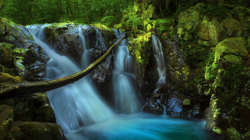
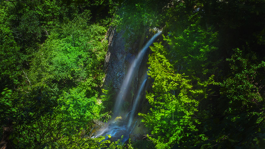
Slide Show
Google Map of Virginia Waterfalls
Stiles Falls is near Allegheny Springs on this Virginia Waterfalls map by Eben Schoeman.