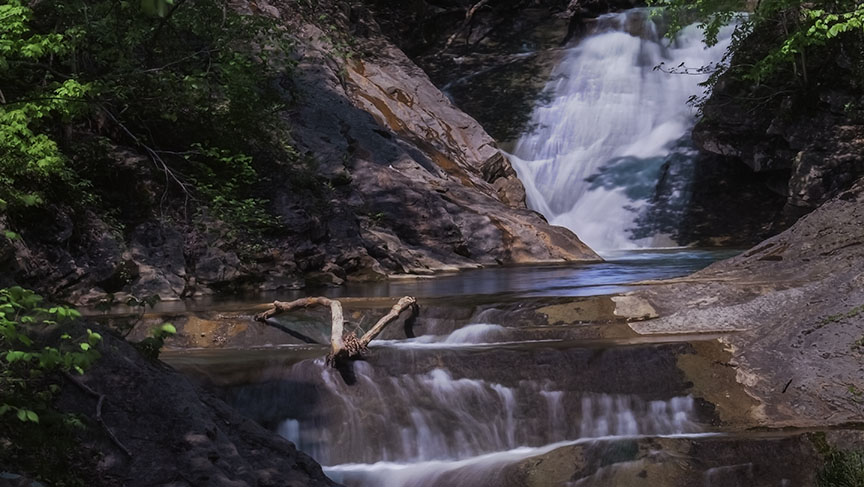
This very popular waterfall between Lexington and Waynesboro, St. Mary’s Falls, should be on everyone’s to-do list!
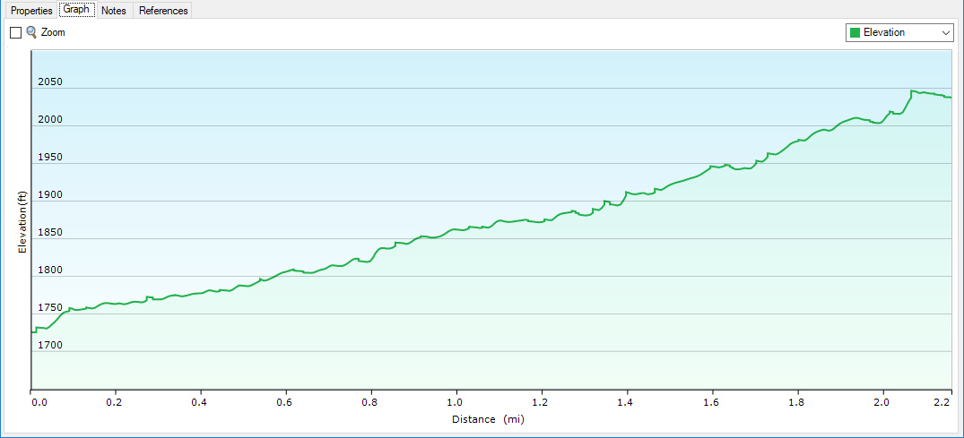
It has everything most hikers look for – plenty of parking on a well-maintained unpaved road, a very steady and gradual trail, and a beautiful waterfall at the 2.2-mile mark!
St. Mary’s River Gorge used to be a very active mining area until the 1950s. In places, some remnants of its past can still be seen.
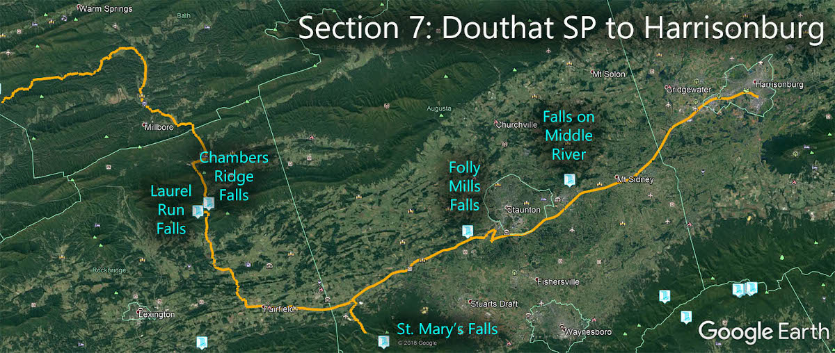
The Great Virginia Waterfall Trail
St. Mary’s Falls is in Section 7 of the Great Virginia Waterfall Trail which travels 106 miles from Douthat State Park to Harrisonburg.
Directions
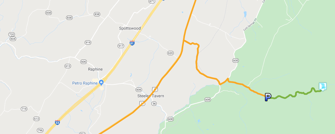
From Steeles Tavern, drive east on SR-56 for 1 mile then turn left on SR-608. After 2.2 miles turn right on to stay on SR-608 and drive a short distance to St Mary’s Road. Turn right. The parking area is 1.4 miles away from where the road ends.
Trail Map
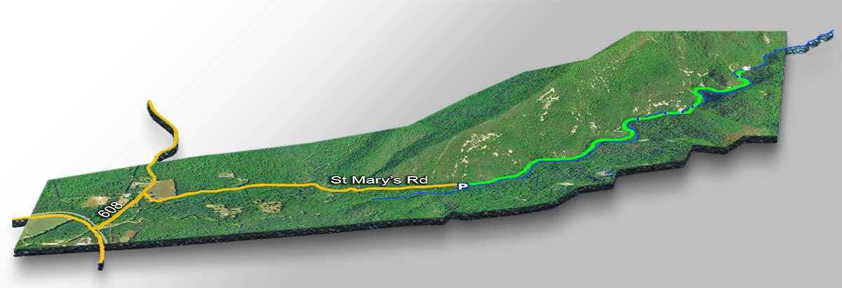
The Trail
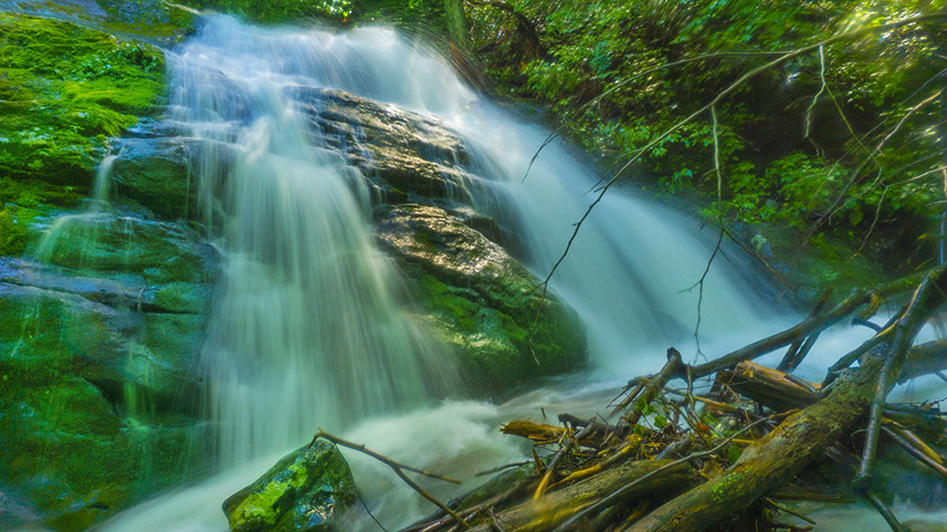
The trail (while rocky in some areas) is easy to follow (orange markers). Be aware you have to cross the creek no less than 5 times meaning your feet will get wet after a rainy period!
Trail Profile
Google Map of Virginia Waterfalls
St. Mary’s Falls is near Steeles Tavern on this Virginia Waterfalls map by Eben Schoeman.