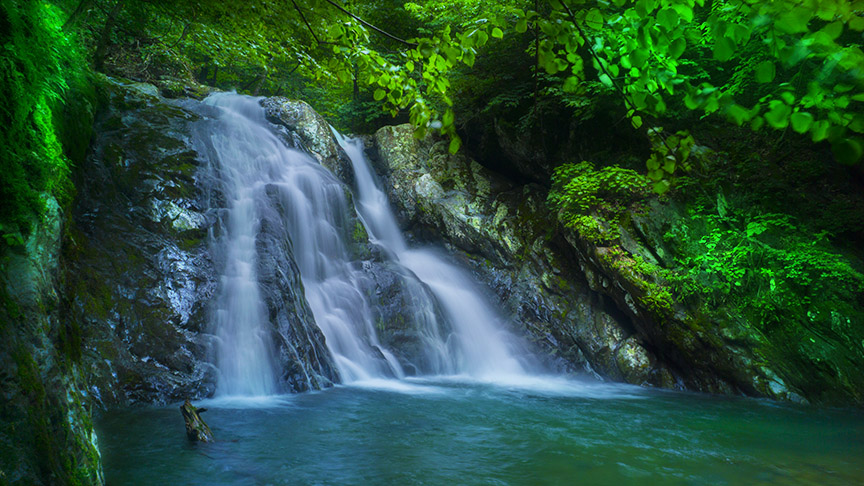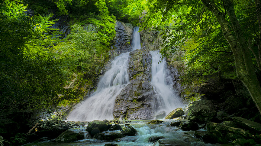
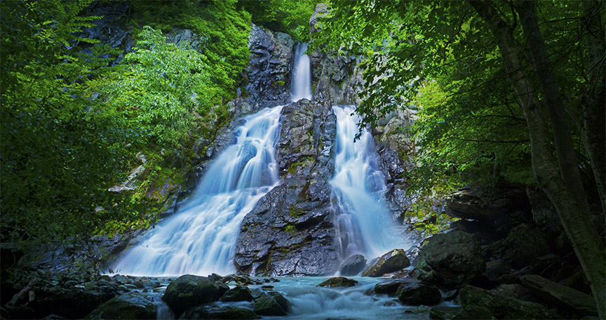
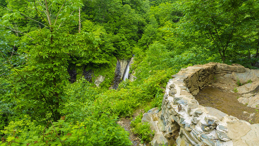
It is said South River Falls (83 feet) is the 3rd highest waterfall in Shenandoah National Park!
Unfortunately, the view from the overlook at 1.3 miles is somewhat disappointing BUT there is a trail down to the base of the waterfall! For some reason, the park rangers do not show this trail on maps!
This “secret” trail makes the steep hike very worthwhile and we recommend a visit – especially after a rainy period.
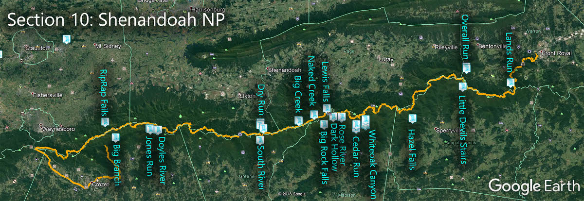
The Great Virginia Waterfall Trail
South River Falls is in Section 10 of the Great Virginia Waterfall Trail which travels the 127 miles of Shenandoah National Park.
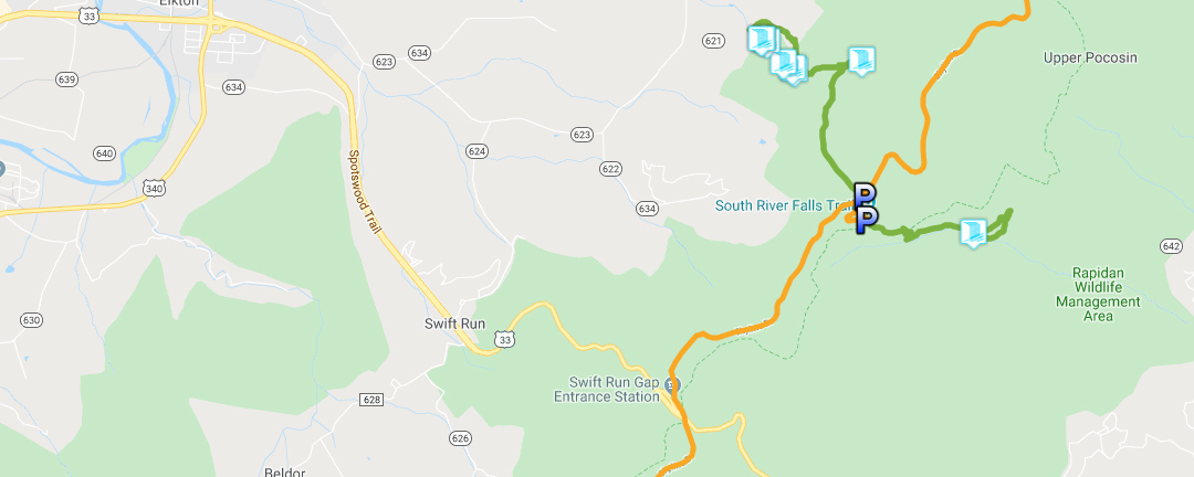
Directions
Park near the trailhead in the South River Picnic Area at Mile 62.8. You will find restrooms nearby.

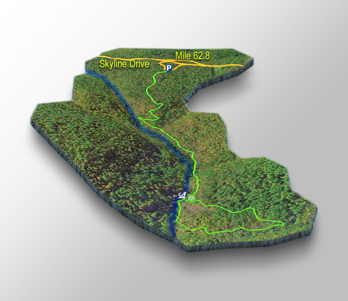
Trail Map
The Trail
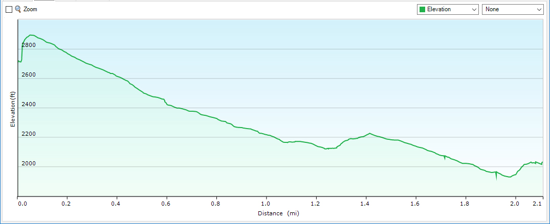
It is 2.15 miles from the parking area to the base of South River Falls.
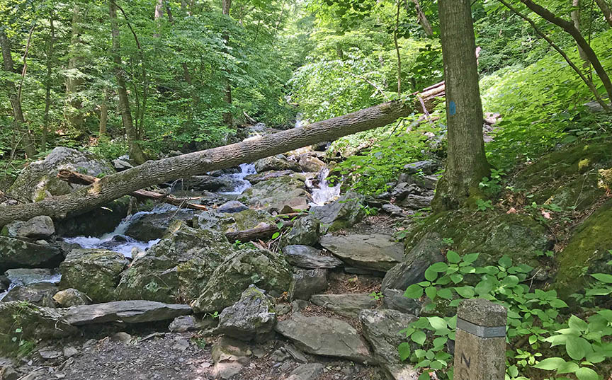
The trail crosses the Appalachian Trail at 0.1 mile then turns downhill with several switchbacks. It is a rough and rocky trail as is typical in Shenandoah so please wear proper shoes!

The overlook at 1.3 miles is where most visitors turn around and return home.
Do not turn back if you are prepared! The trail will get rougher but it is marked with blue blazes to the river.
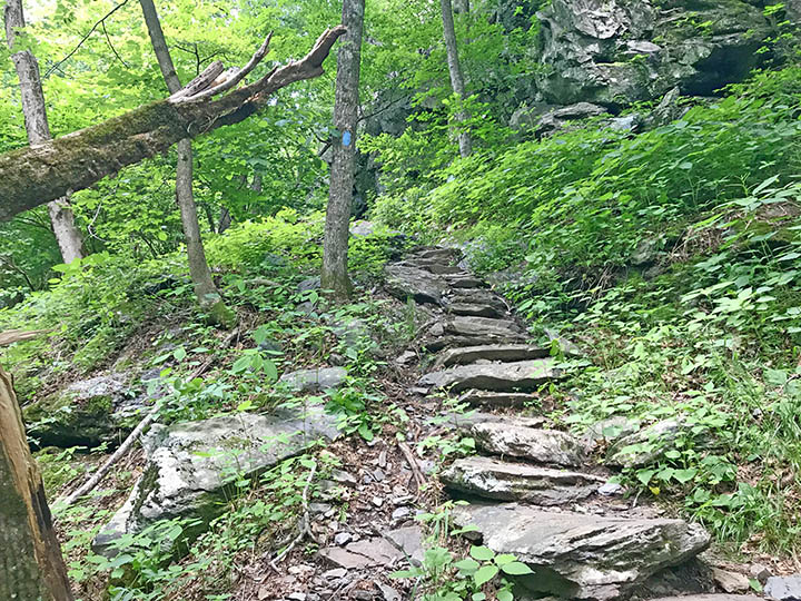
At the river, do not cross! Look to your right and you will see more blue blazes leading you uphill through the foliage.
After just a short, rocky hike you will find yourself at the base of South River Falls!
Trail Profile
Google Map of Virginia Waterfalls
South River Falls is in Shenandoah National Park on this Virginia Waterfalls map by Eben Schoeman.