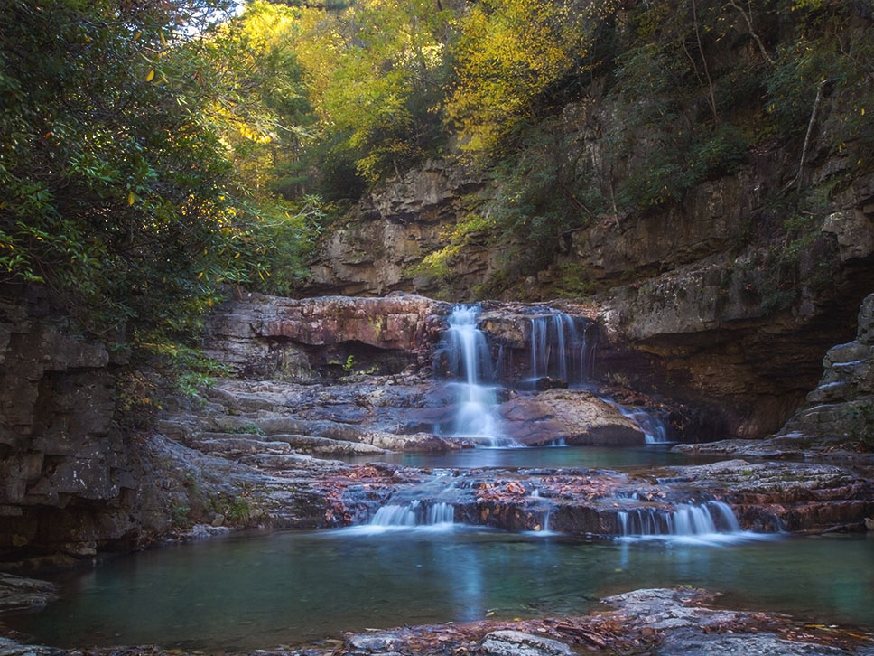
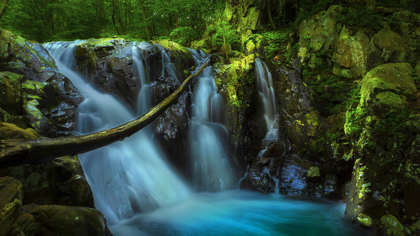
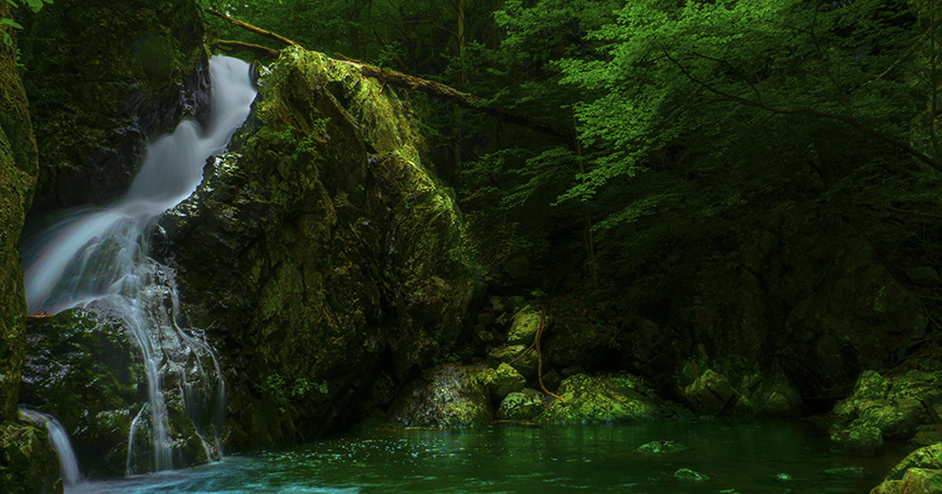
Rose River Falls is one of the prettiest in Shenandoah! After heavy rain, there may be several parallel falls tumbling over the 67-foot rock face.
The Great Virginia Waterfall Trail
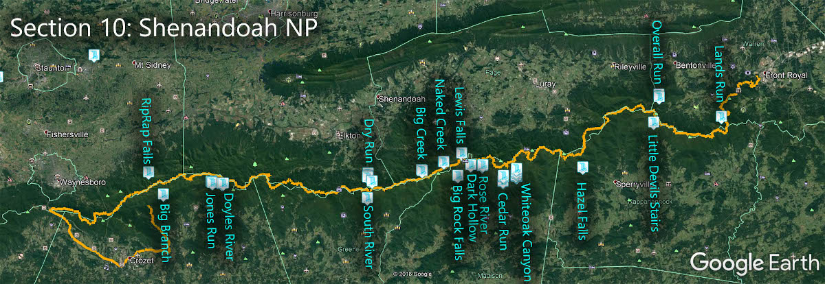
Rose River Falls are in Section 10 of the Great Virginia Waterfall Trail which travels the 127 miles of Shenandoah National Park.
Directions
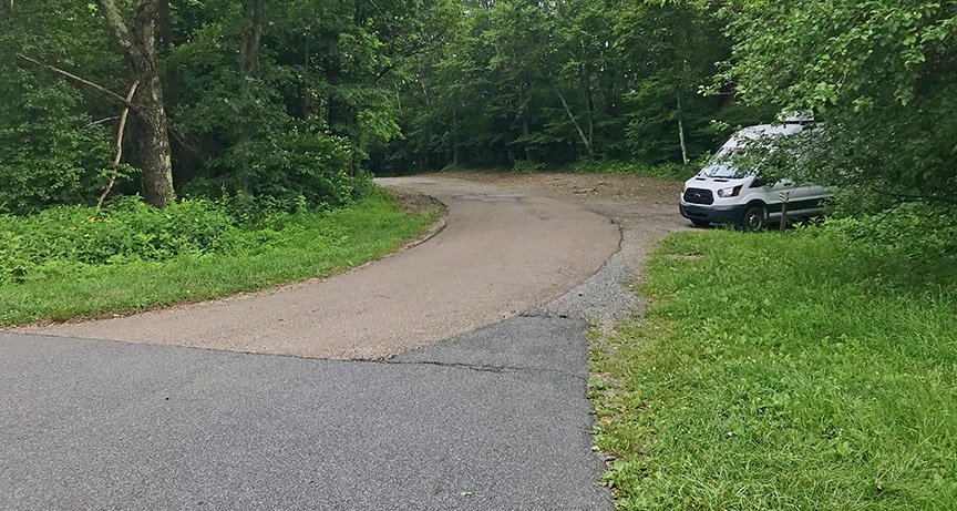
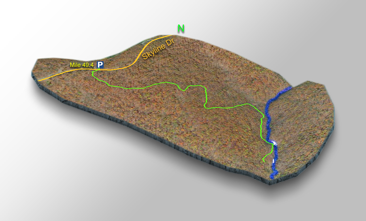
Park at Fishers Gap Overlook at mile 49.4. I prefer the area along the fire road nearby BUT DO NOT BLOCK the road. Then cross Skyline Drive and enter the trail.
Trail Map
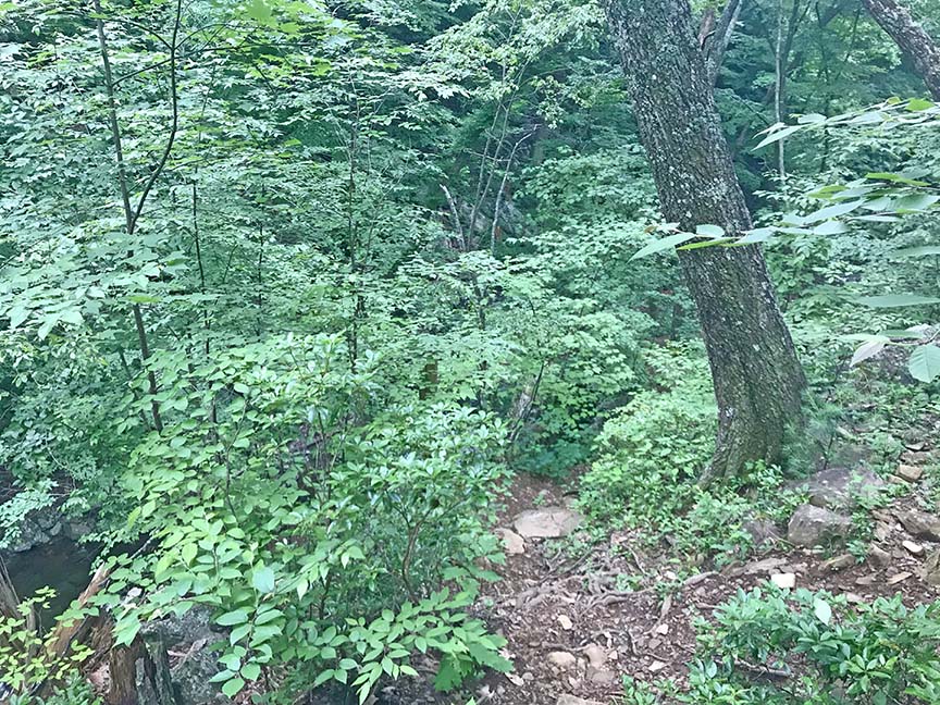
The Trail
The first 0.5 miles is also a horse trail – please know horses have the right of way. After 0.9 miles the Rose River comes into view of the left. Follow the trail to Rose River Falls #1 (main falls) at 1.25 miles.
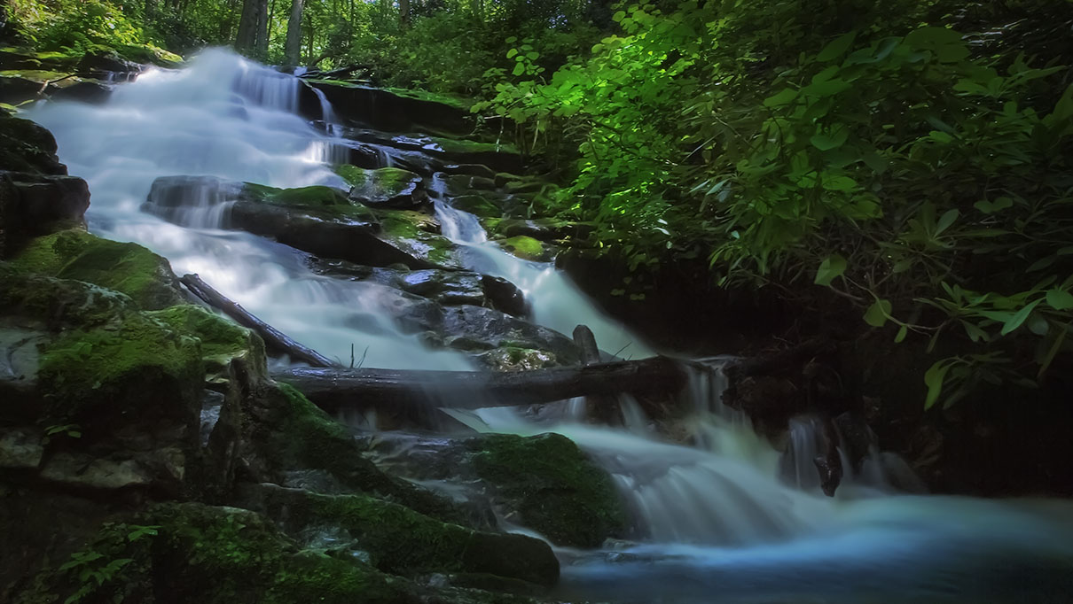
But there is more! Continue to mile 1.35 then bushwack down to Rose River Falls #2. You will see the top of the falls first then carefully make your way down to its base – it is very steep.
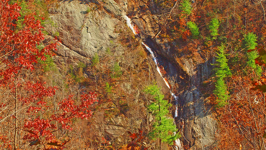
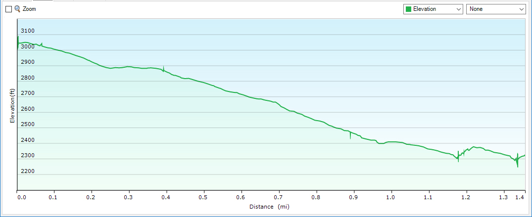
Trail Profile – Rose River Falls
Google Map of Virginia Waterfalls
Rose River Falls is in Shenandoah National Park on this Virginia Waterfalls map by Eben Schoeman.