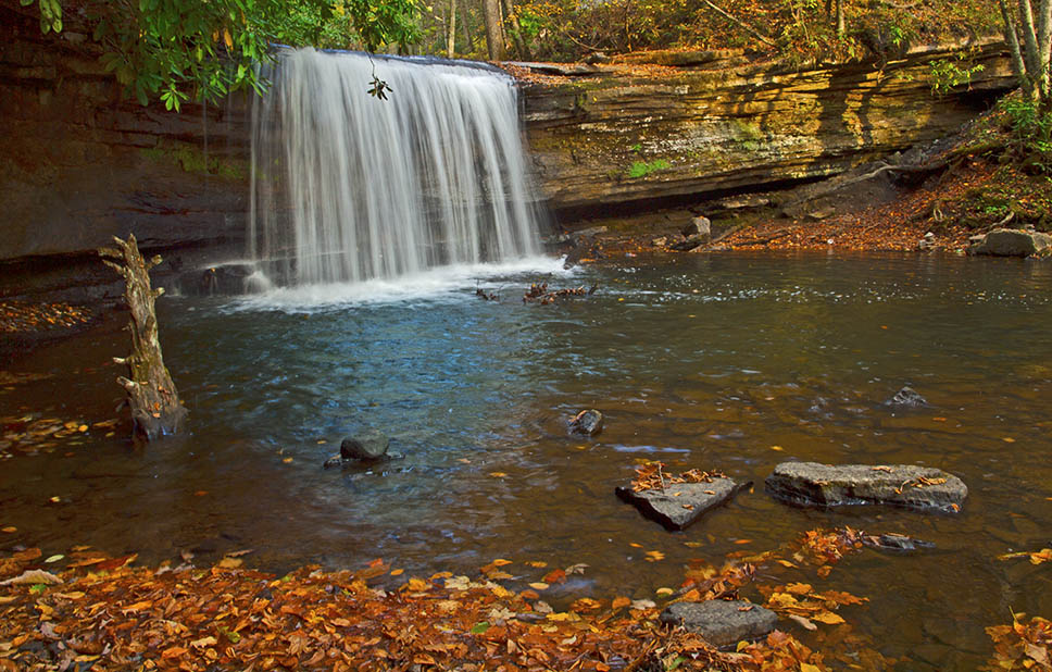
If you are looking for an exciting hike next to a stream to a very photogenic waterfall then Roaring Run Falls should be near the top of your list!
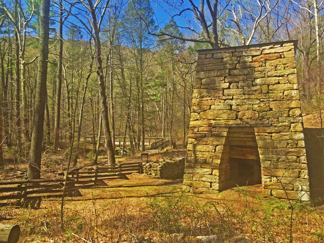
But there is more! You can follow the trail upstream to the waterfalls and return via a different forest trail that includes a scenic viewpoint and a visit to a 19th-century iron furnace!
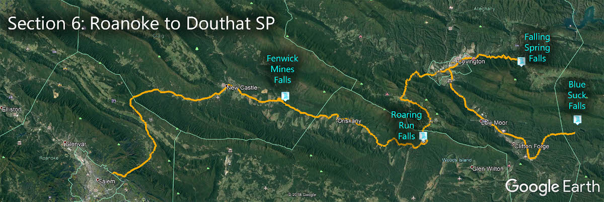
The Great Virginia Waterfall Trail
Roaring Run Falls is in Section 6 of the Great Virginia Waterfall Trail which travels 115 miles from Roanoke to Douthat State Park Gap.
Directions
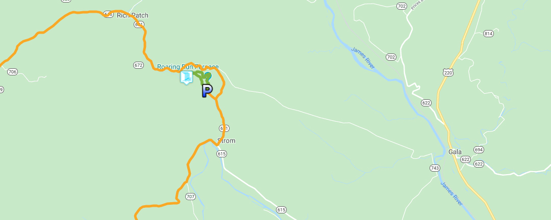
From Eagle Rock, drive north on US220 and turn left on Craig Creek Road (VA615). After 5.5 miles turn right on Roaring Run Road (VA621) and look for the entrance to Roaring Run Recreational Day Use Area on the left after 1 mile.
Trail Map
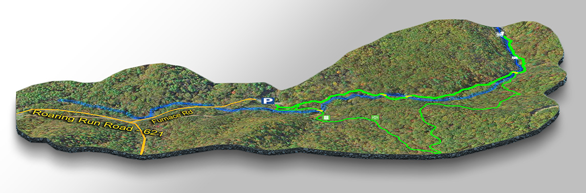
The Trail
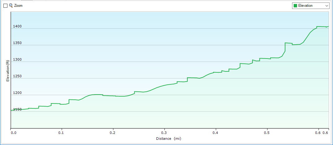
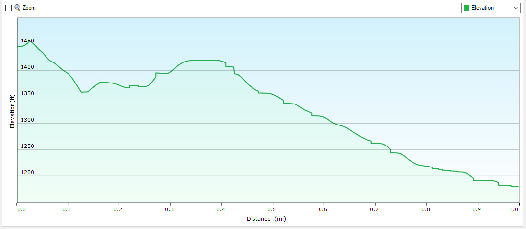
On the trail map, you can see the two main trails. We prefer to hike in a clockwise direction – upstream 0.6 miles to the Falls on the Streamside Trail and return via the furnace on the Woodlands Trail (1 mile).
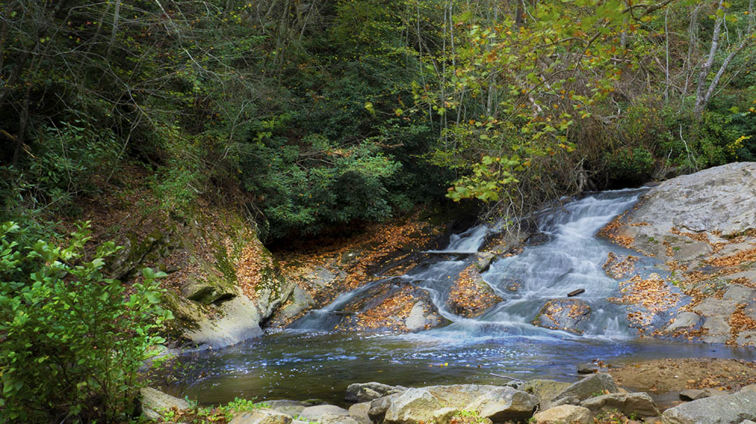
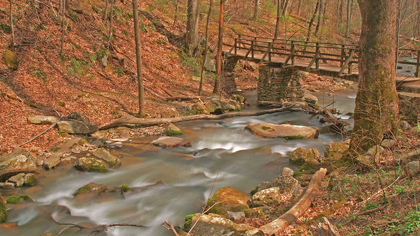
Shortly after the 3rd bridge, there is a sliding rock cascade which is great fun on a hot day! Bring your swimwear!
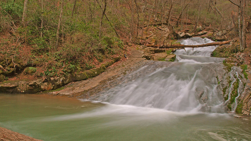
The trail is beautifully maintained and you cross 3 bridges on your way to the Falls – you do not have to get your feet wet!
Roaring Run Recreational Area offers much more than a waterfall! It is the kind of place one can visit time and time again to hike and picnic.
Trail Profiles
Google Map of Virginia Waterfalls
Roaring Run Falls is near Strom on this Virginia Waterfalls map by Eben Schoeman.