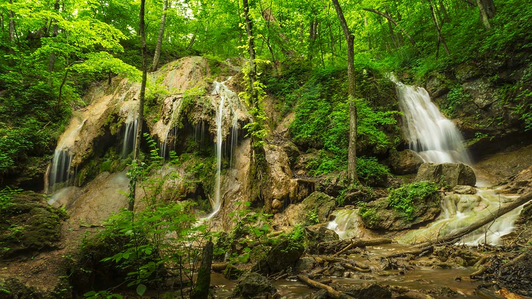
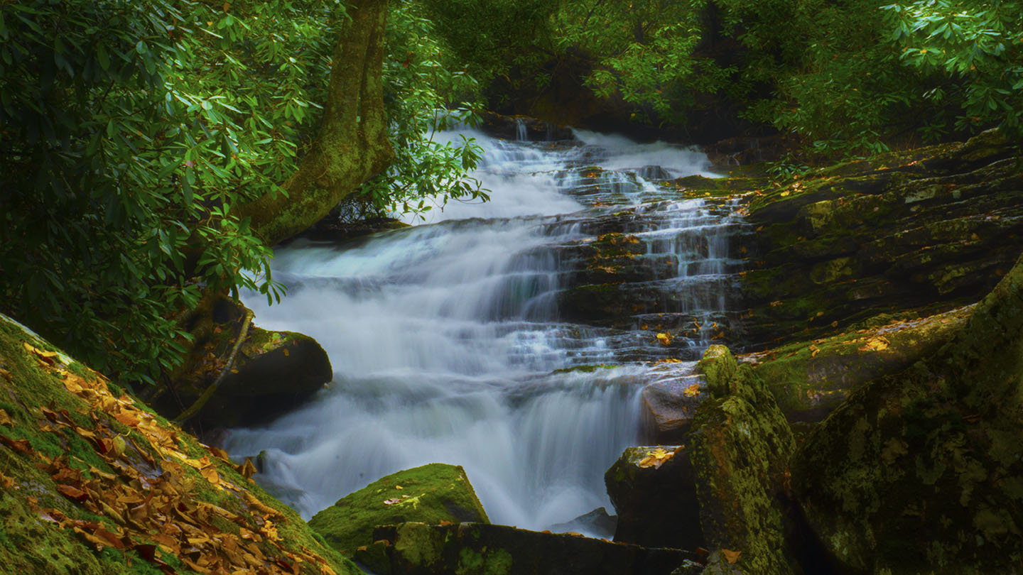
Mill Creek Nature Park near Narrows in Giles County, Virginia is home to three large waterfalls and many cascades depending on water levels.
The Main Falls – also known as Middle or 2nd Falls – is the star attraction. It is a beautiful area and well worth visiting.
Please be aware that the trail is rocky, rough, and steep in places! Watch the slideshow below to decide if the trail is in your comfort zone.
The Great Virginia Waterfall Trail
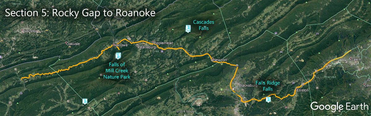
The Falls of Mill Creek is in Section 5 of the Great Virginia Waterfall Trail which travels 80 miles from Rocky Gap to Roanoke.
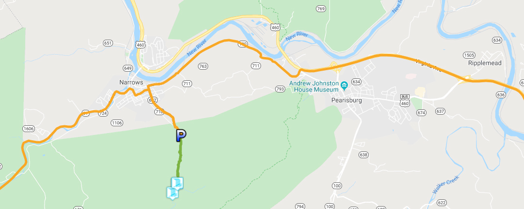
Directions
From Main Street in Narrows turn South East on Northview. The parking lot is at the end of Northview Street (CR652). You can also approach it from Poplar Street (CR710).
Trail Map
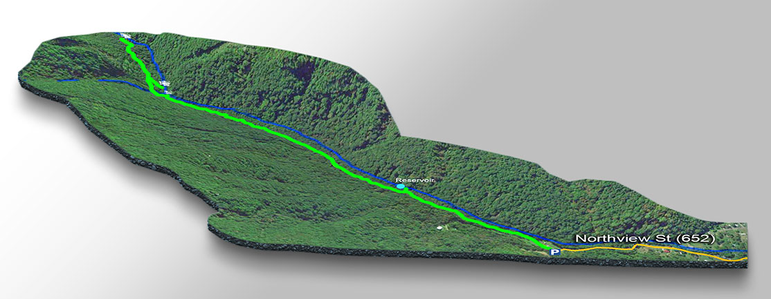
The Trail
Wear proper shoes and keep a close eye on younger children who may slip and fall. The trail is hard to follow in some sections over the rocks; look closely! Mill Creek can be raging after heavy rains and the trail can be slippery so be careful.
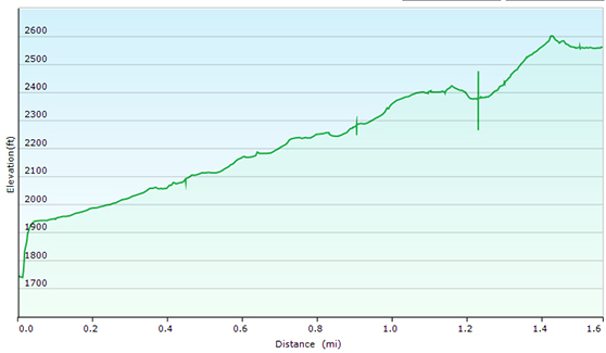
As shown on our trail map, the trail follows Mill Creek upstream for 1.6 miles to the Upper or 3rd waterfall. The trail does continue and there are other trails as shown on the map near the parking area but keep close to the Creek and you will eventually reach the waterfalls!
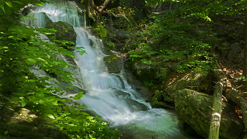
The Lower Falls (at 1.1 miles) turn into Twin Falls after heavy rains! Unfortunately, you have to bushwack a short and steep distance down to the Creek to see these Falls!
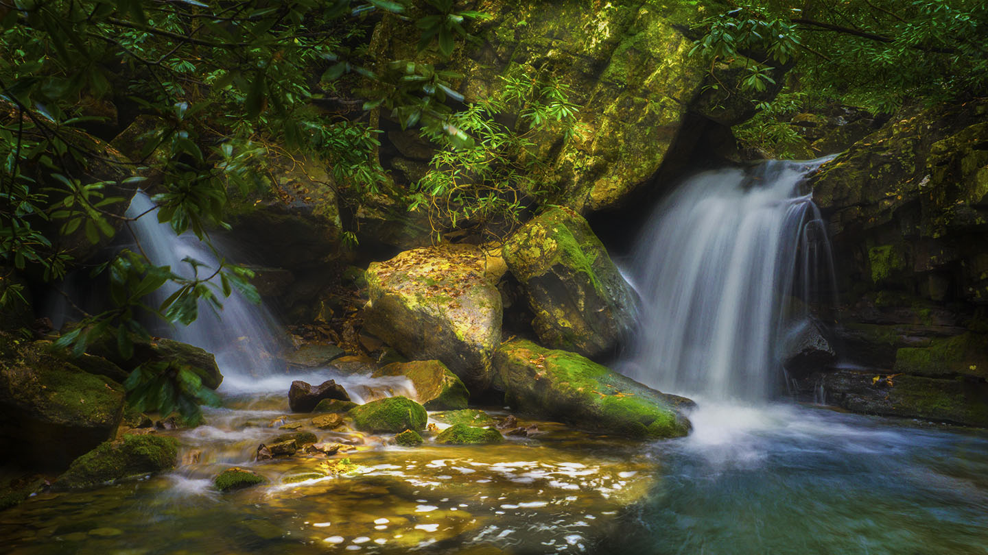
The Main (Middle) Falls (at 1.2 miles) have a small sign to points to a side trail down to the Creek. This is a narrow, steep, and slippery (muddy) section but you will soon be rewarded with the beautiful Main Falls!
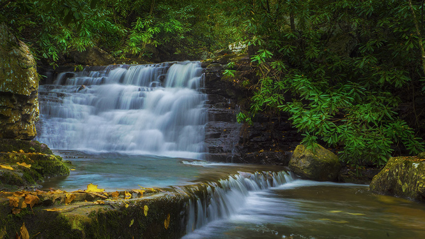
Retrace your steps back to the main trail then turn right and hike up a steep narrow hill to the next waterfall sign. The Upper Falls (at 1.6 miles) is a raging cascade between large boulders and are difficult to photograph but still worth the effort!
Trail Profile
Slideshow of the Trail
Google Map of Virginia Waterfalls
The Falls of Mill Creek Nature Park is near Narrows on this Virginia Waterfalls map by Eben Schoeman.