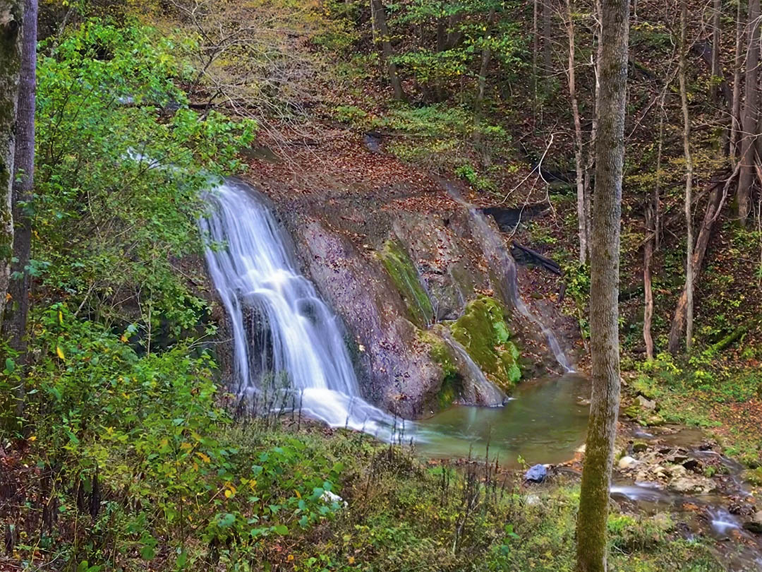
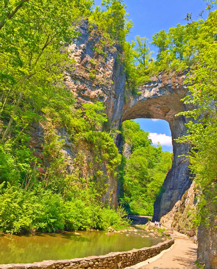
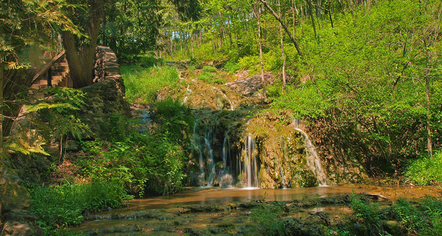
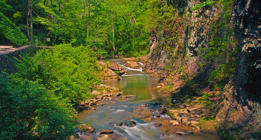
Lace Falls is a wonderful surprise at the end of the Cedar Creek Trail in Natural Bridge State Park! What makes the 30-foot cascade even more special is the path; it is accessible to all!
And then there is the romantic Natural Bridge Hotel!

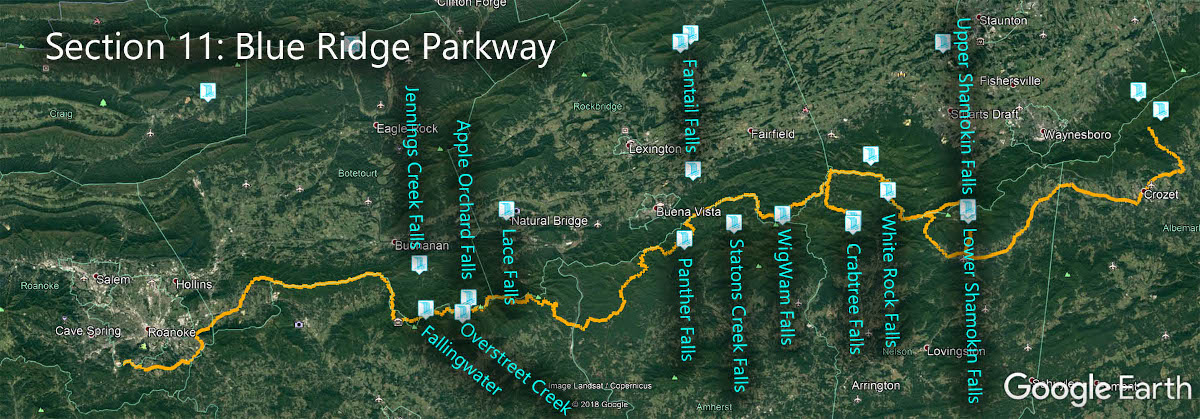
The Great Virginia Waterfall Trail
Lace Falls is in Section 11 of the Great Virginia Waterfall Trail which travels 170 of the Blue Ridge Parkway.
Directions
Take Rte 11 to the Visitor Center across the road from the Natural Bridge Hotel.

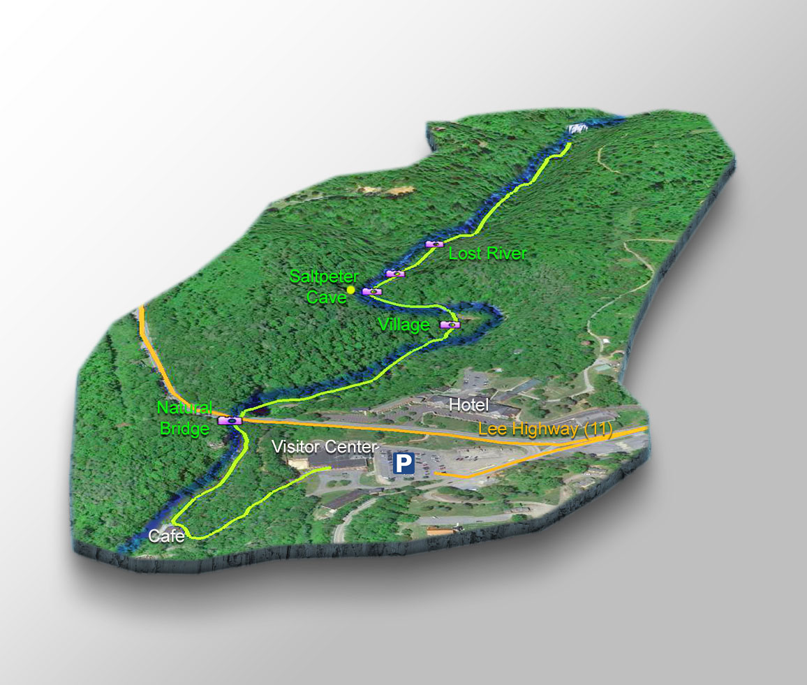
Trail Map
The Trail
Be warned – the start of the trail is down a long and steep flight of stairs. There is scheduled transportation down to the Natural Bridge if you do not want to tackle this steep section on foot!
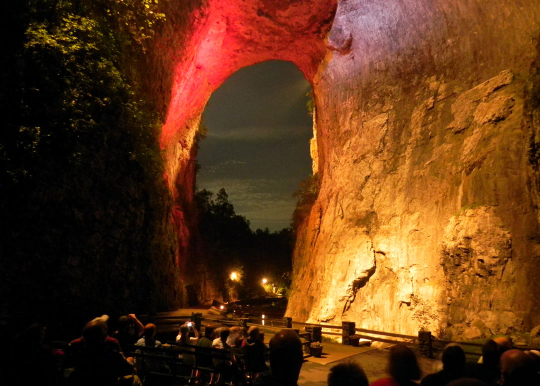
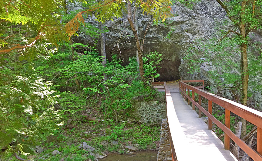
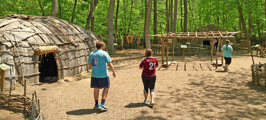
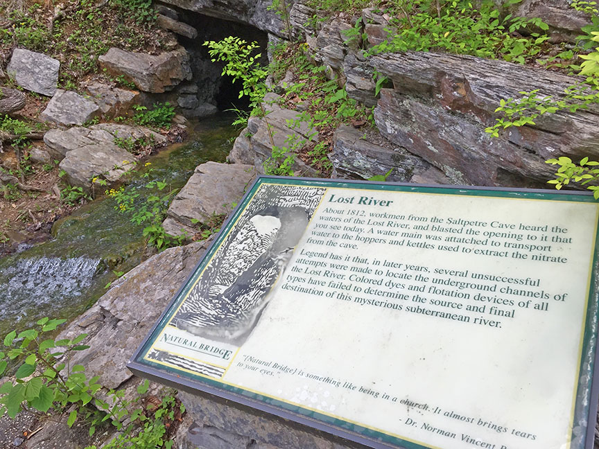
Along the 1.1-mile trail, there is a cafe, the stunning 215-foot tall Natural Bridge, a recreation of a Monacan Village, a cave, and other interesting stops!
After paying the entrance fee, proceed down to the Trail. Do stop to look at the limestone cascade to your left as you reach the bottom.
Then proceed to your right past the Cafe.
Google Map of Virginia Waterfalls
Lace Falls is in Natural Bridge State Park on this Virginia Waterfalls map by Eben Schoeman.