A detailed guide to FREE National Forest dispersed camping near Las Vegas in Nevada.

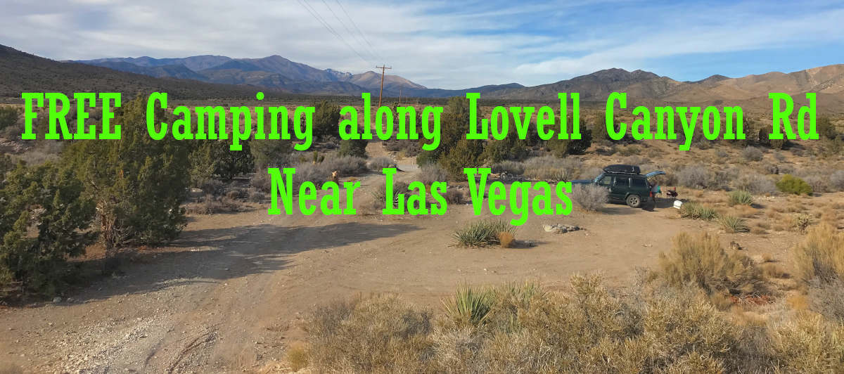
As shown on the map below, this article covers dispersed Humboldt-Toiyabe National Forest camping along Lovell Canyon Road in the Spring Mountains National Recreation Area off SR160 near Las Vegas.

Location
From the Las Vegas Strip it takes about 40 minutes – 28 miles.
Turn right to Dean Martin Dr. After 4 miles, turn right onto NV-160 W/Blue Diamond Rd. After 21 miles turn right onto Lovell Canyon Rd.
The camping area begins after the information board. It is a tarmac road all the way. Just look for turnouts and forest roads to the right and left.

Area GPS Map
I highly recommend the Avenza Maps App!
Load the Humboldt-Toiyabe NF Spring Mountains NRA North MVUM. A better option is the Mountain Springs 2018 or later Geological Survey Map. Unfortunately, neither are very detailed. Just use my Google Map below.
On the map below, click on the square in the top-right corner for a full-screen view.
Lovell Canyon Road Camping
The stay limit is 14 days.

Most folks camp within 5 miles of the entrance and close to the main tarmac road. If your vehicle can handle the terrain, do explore the side roads for very nice, secluded sites. Lovell Canyon Road continues further but I did not explore beyond 5 miles because cell service became an issue at that point.

For the first 2 miles or so, most (if not all) of the camping will be to your right due to the wash on the left. Some of the forest roads are rough and sandy so it is best to park and walk ahead to make sure your vehicle can handle the conditions. Fortunately, these are short drives as shown on my map above.

The most popular campsites start near the 3-mile mark. These are on both sides of the road.

The best views are from the top of the hill after the 4-mile mark but the access roads are short and steep and/or rough!


RV size limits?
This area is popular with vehicles of all sizes. Larger RVs have to stay closer to the tarmac road where there are very large sites with easy access.

Cell Service
Verizon service is very good but gets weaker the further one parks away from SR160. It gets a bit spotty after the 4-mile mark.