Updated for 2024
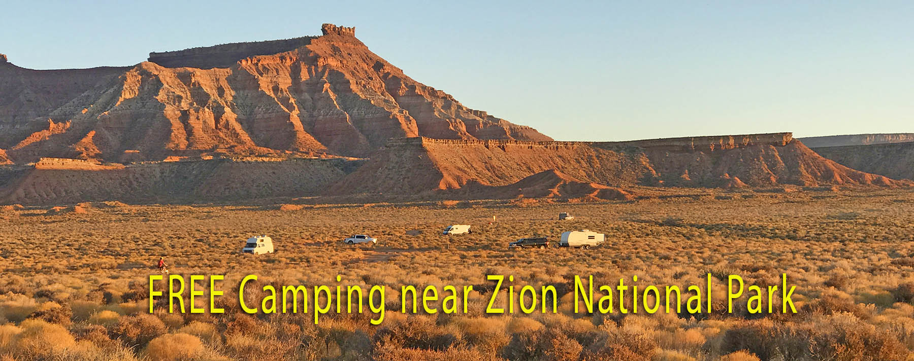
This is a complete guide to FREE camping on BLM land near Zion National Park in Utah. There are free camping opportunities to the east and the west of the Park – this guide focuses on the west side of the Park.

To camp to the East, please read my Guide – Camping FREE on BLM land East of Zion.
In this guide, you will find maps with directions, updates on road conditions, locations of most campsites, and availability of amenities such as cell coverage, water, and toilets,
About Zion National Park and BLM land
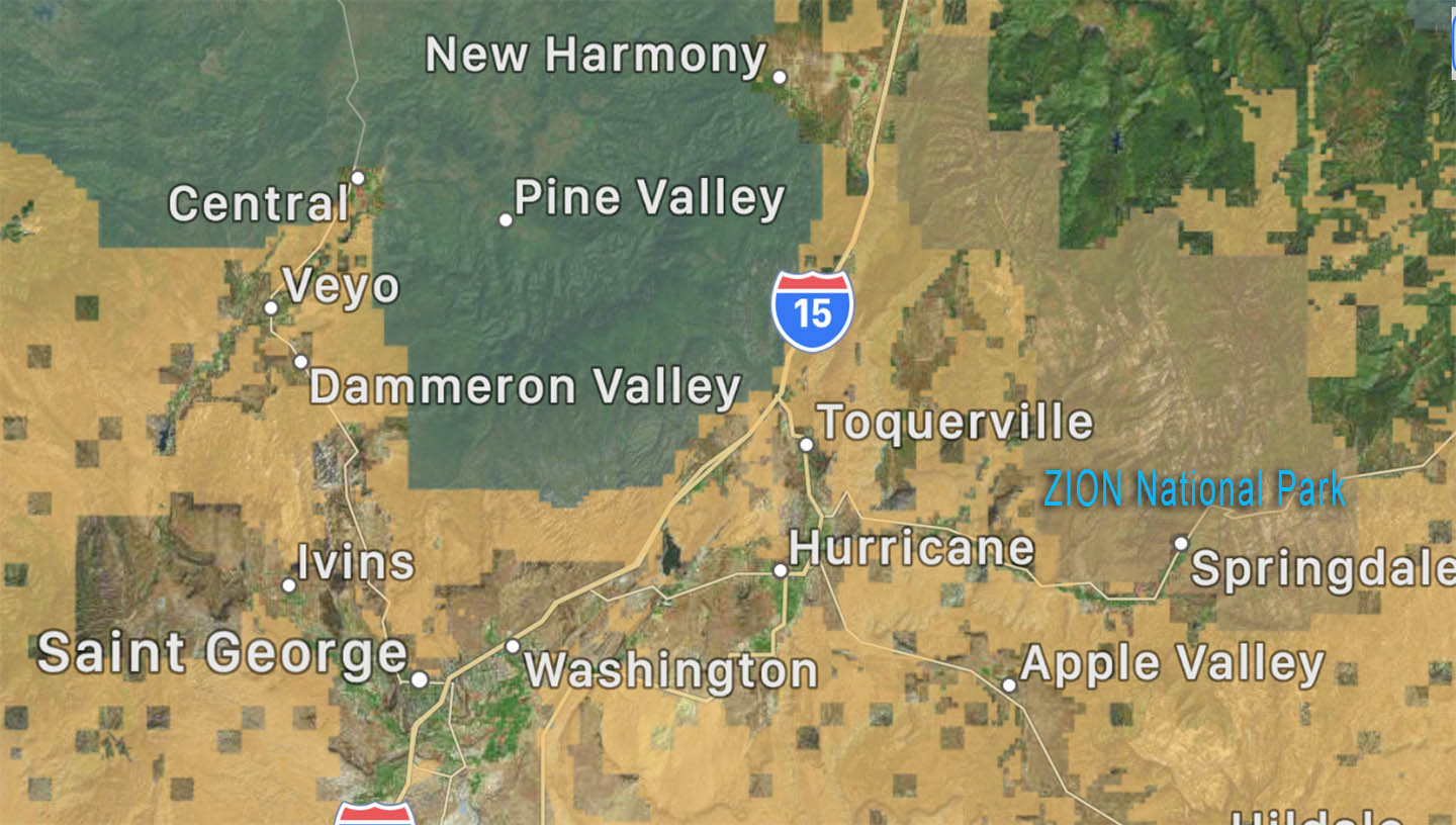
Zion National Park is almost surrounded by BLM land and National Forests. The St George Field Office manages the BLM land west of Zion.
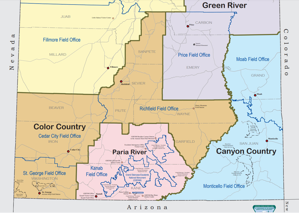
The BLM District office is in Cedar City – it manages four field stations including the St George Field Office. St George Phone: (435) 688-3200
Maps and Directions
I highly recommend the Avenza Maps App!
Unfortunately, at this time there are no Motor Vehicle Use Maps for the area west of Zion National Park. Google Maps and Google Earth are your best friends in this area!
For directions, I suggest you download the Zion National Park map for Avenza.
To see the boundaries of the BLM land where you are camping, refer to the Interactive BLM Utah map
Camping inside or near Zion National Park
Zion National Park has three campgrounds. South and Watchman Campgrounds are in Zion Canyon. The Lava Point Campground is about 80 minutes from the South Entrance along the Kolob Terrace Road.
There are many private campgrounds in nearby towns.
Recommended FREE Camping Areas on BLM land nearest to Zion NP
Dispersed camping is allowed on public land for a period not to exceed 14 days within a 28-consecutive-day period. The 28-day period begins when a camper initially occupies a specific location on public lands. The 14-day limit may be reached either through several separate visits or through 14 days of continuous overnight occupation during the 28 days.
After the 14th day of occupation, the camper must move outside of a 25-mile radius of the previous location until the 29th day of the initial occupation.
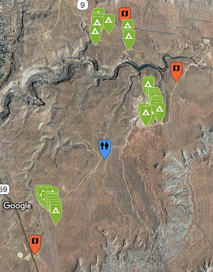
As shown on the map below, there are five well-known FREE camping areas within an easy drive from Zion NP. Of these, Smithsonian Butte is now off-limits for the casual camper (reasons described below). The others are:
- N Kolob Terrace Rd – many sites on both sides of the road near North Creek
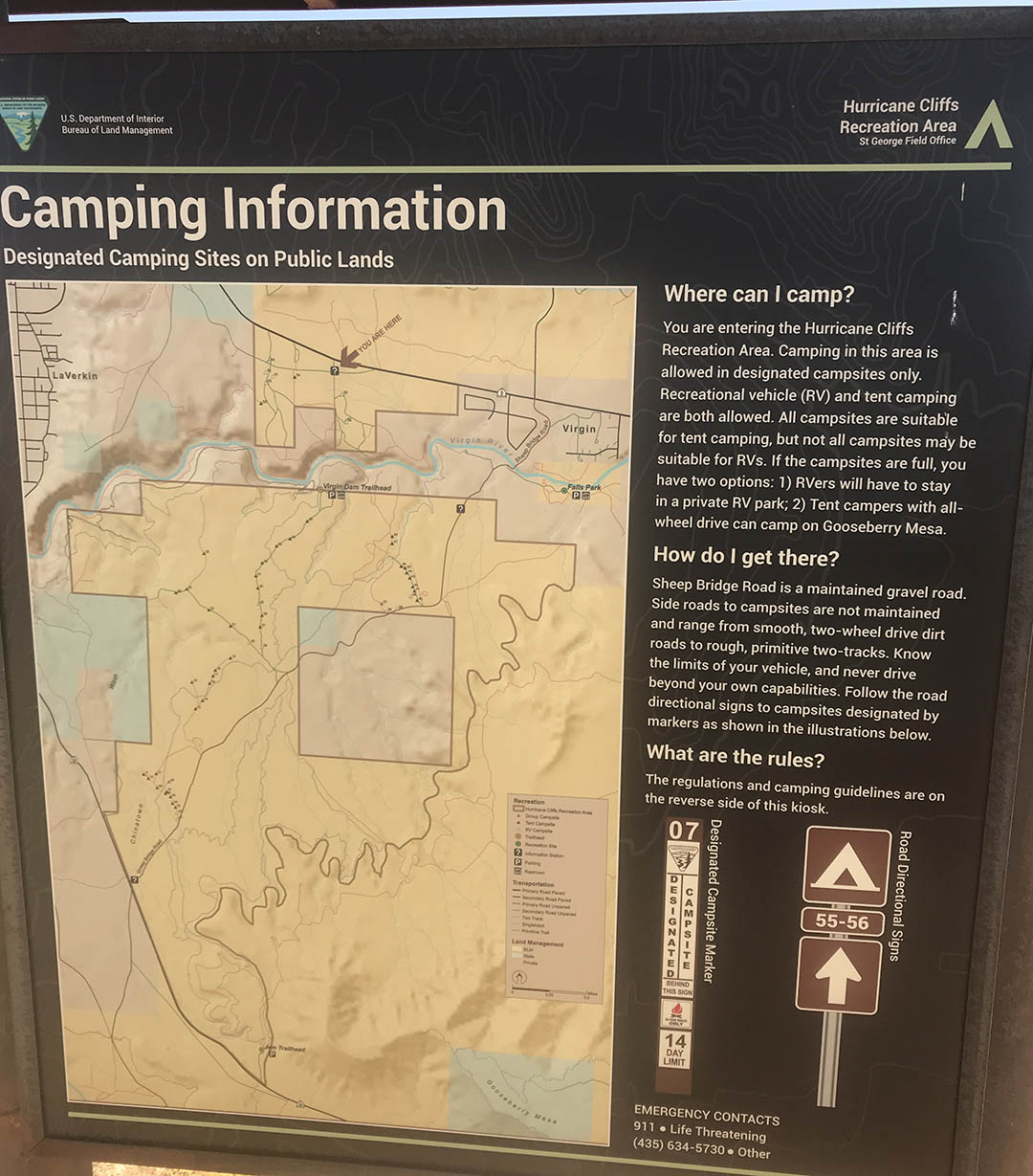
- Hurricane Cliffs (Sheep Bridge Rd) – East – thirteen designated campsites on the west side of Sheep Rd
- Hurricane Cliffs (Sheep Bridge Rd) – South – twelve designated campsites on the west side of Sheep Rd but further away from Zion NP
- Hurricane Cliffs (La Verkin Overlook Rd) – West – eight designated campsites close to Virgin Dam and nearby trails
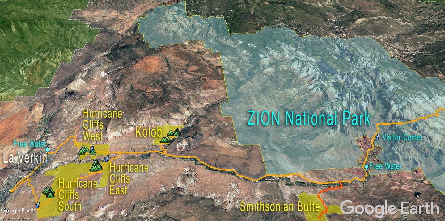
NOTE – What about the very popular Smithsonian Butte National Back Country Byway? It is close to Zion NP but you cannot camp within 1/2 mile on either side of the road! Read the Rules. This makes practical camping not feasible for Zion visits, especially with terrible road conditions and steepness.
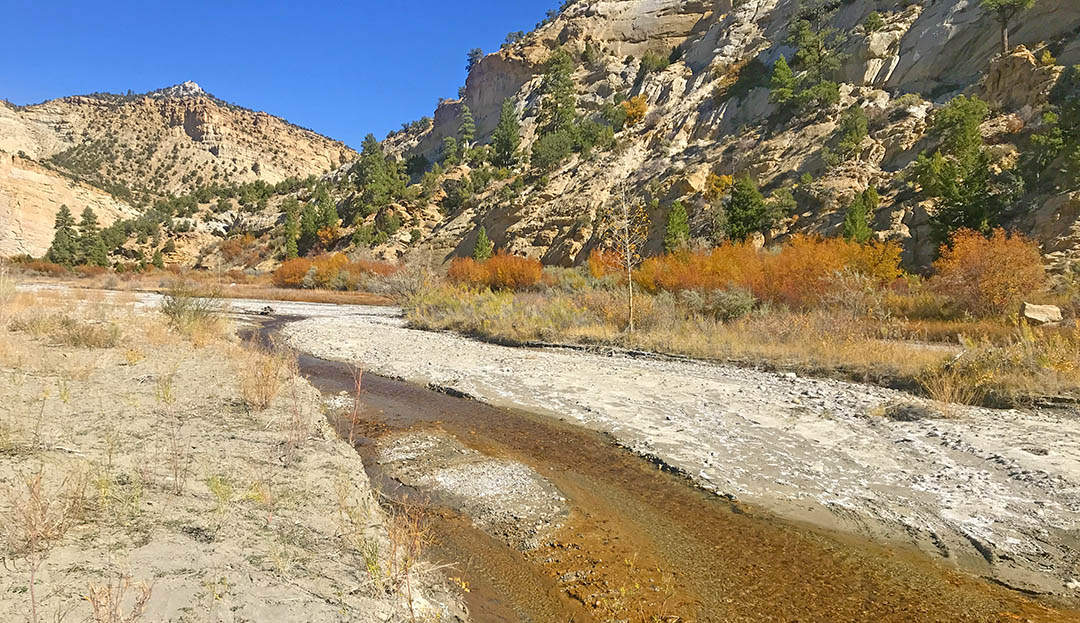
Free Camping in the N Kolob Terrace Rd area
If you plan to spend a lot of time in Zion and are looking for minimum dirt road driving, then you should consider this area. N Kolob Terrace Rd is tarmac.
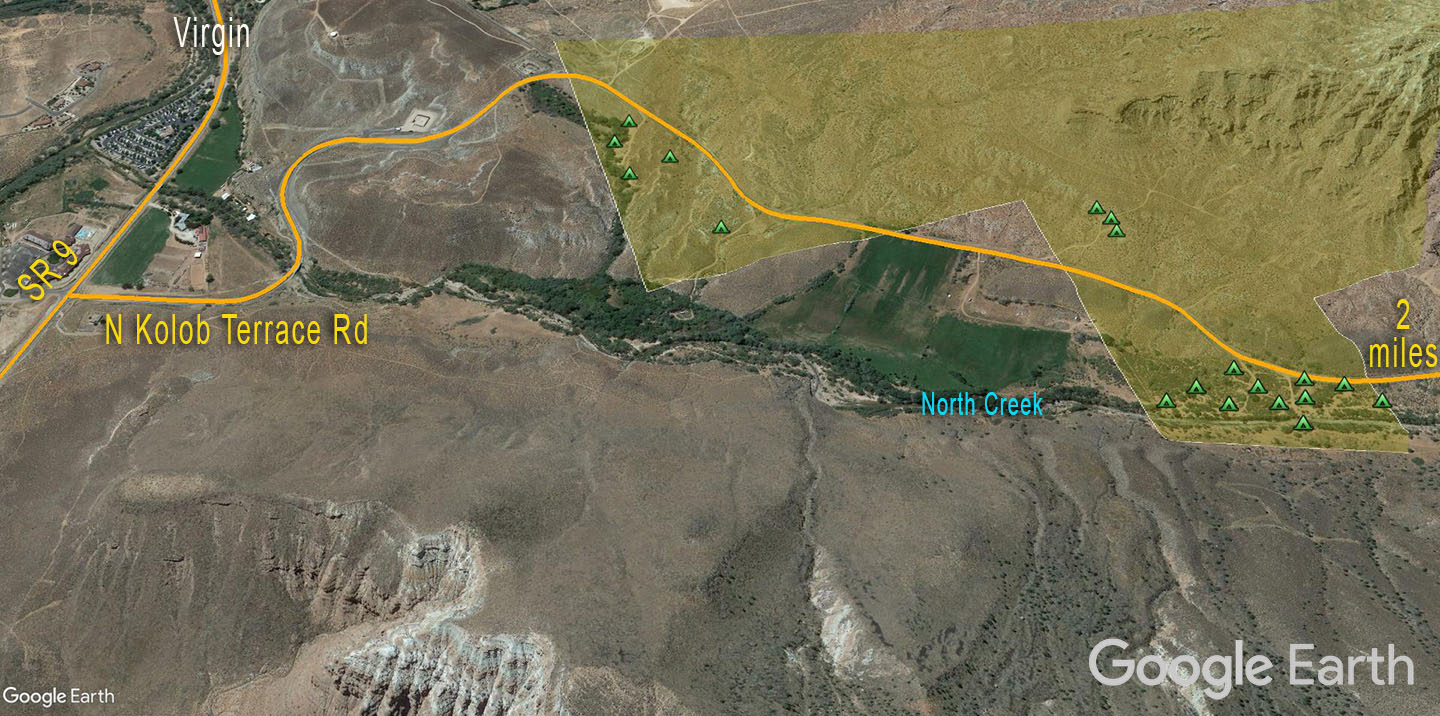
In the map above, you see three sets of campsites – the first batch is to the right after about a mile, then a few sites towards the mesa on the left after about 1.6 miles followed by the North Creek area camping just before 2 miles.
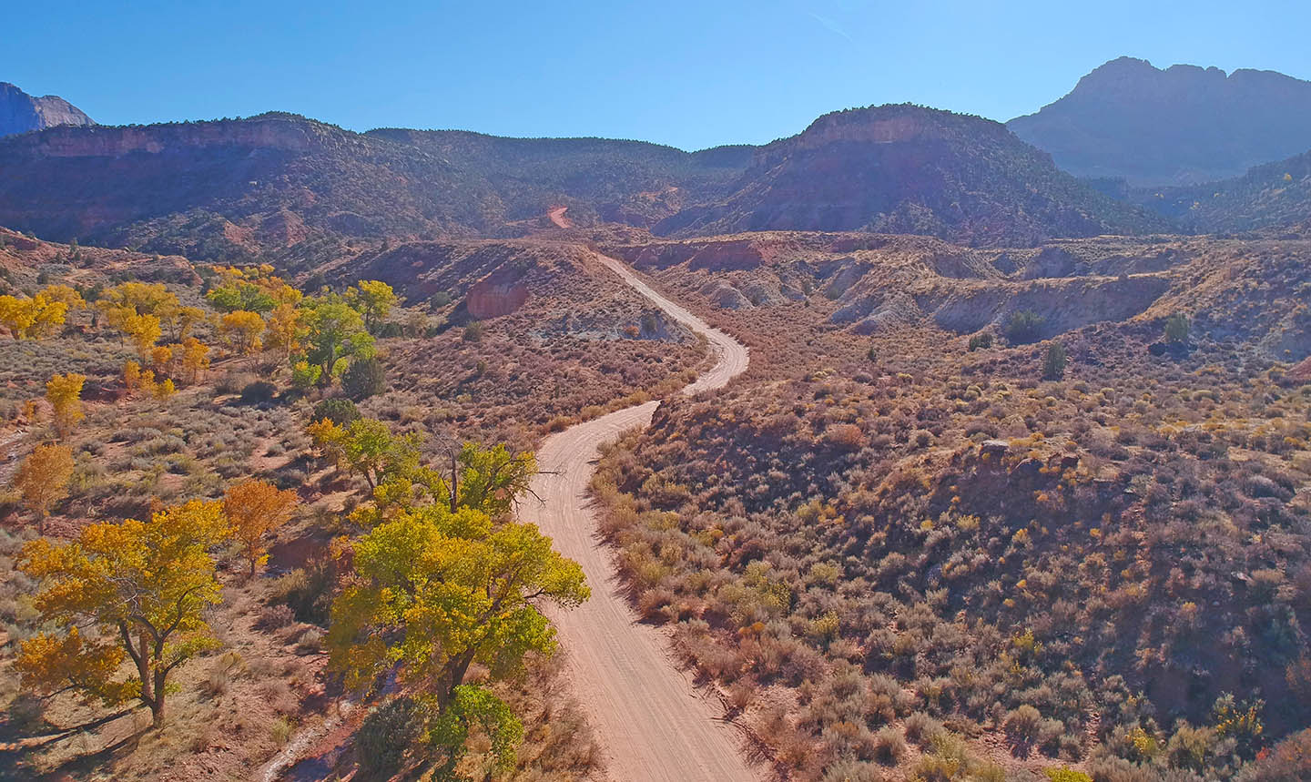
The dirt roads towards the mesa are very bad but short! You can find secluded spots there.
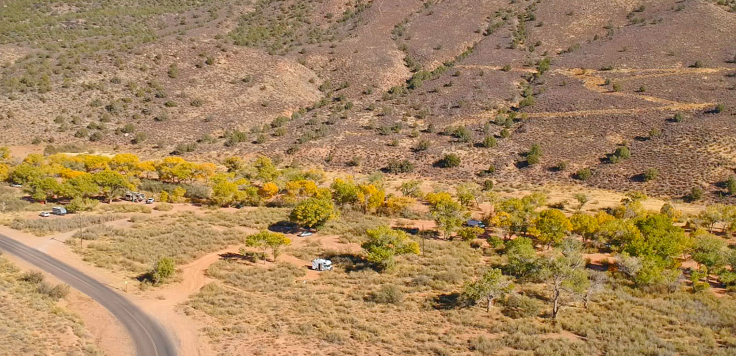
The creek area has many sites but the vegetation keeps them relatively private. On busy nights there are lots of RVs in there and you may have to deal with close neighbors and noise.
Having some shade in summer (with a cool stream) is certainly a plus for the creek area!
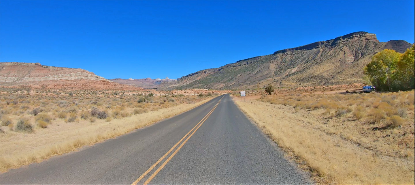
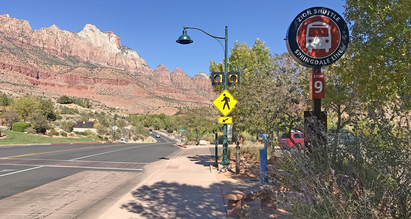
About potable water and toilets – as shown on the map you can either drive to La Verkin (Maverik fuel with a free dump station) or the first bus stop in Springdale (water).
Verizon has a very spotty (if any) LTE service at these campsites.
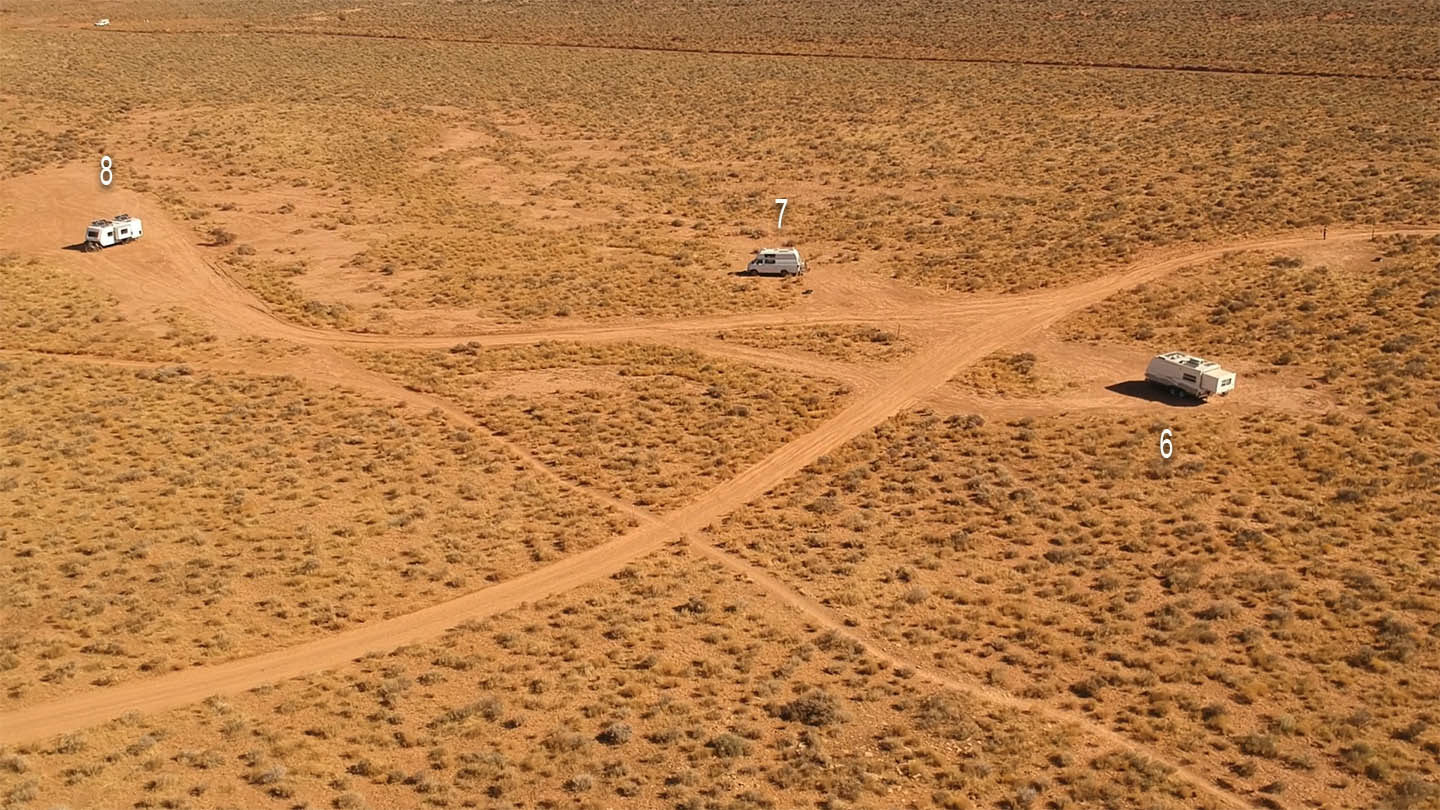
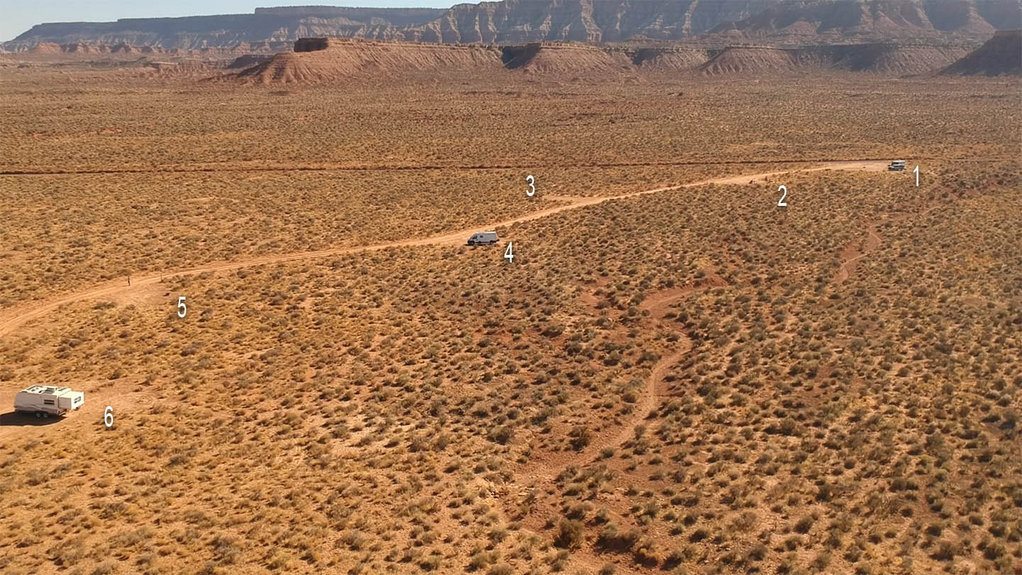
Free Camping in the Hurricane Cliffs (Sheep Bridge Rd) East Area
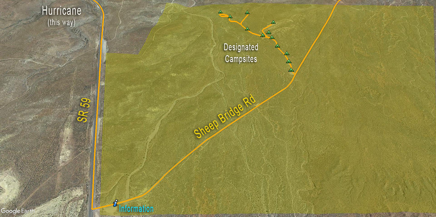
To escape the crowds you can head south on Sheep Bridge Rd out of Virgin for 1.75 miles. The dirt road is washboard at times but very doable in all vehicles.
But be warned – on mountain bike event weekends the place gets crazy busy and dusty!
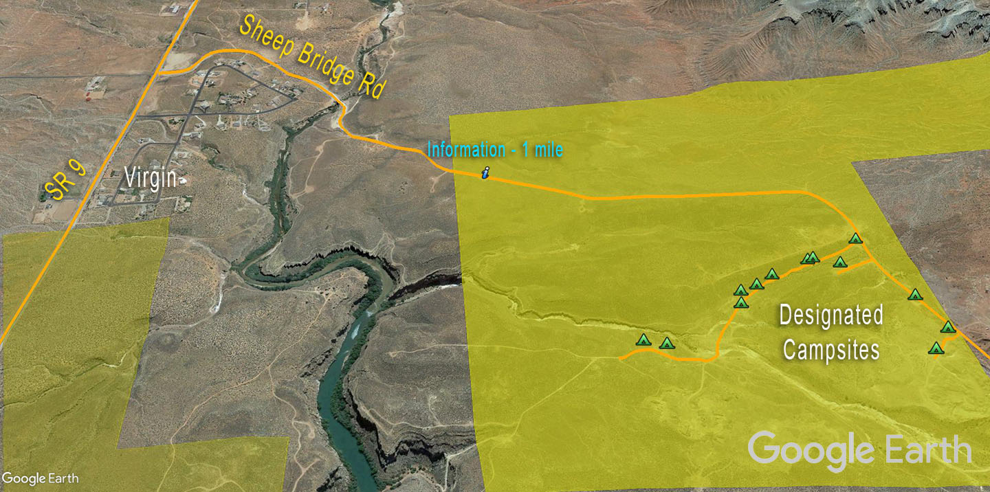
Do stop at the information board after a mile to read the rules and look at the camping maps.
The first camping area is to the right (after 1.75 miles) and you MUST camp in one of the 9 designated sites.
There are 4 more sites a short drive further south. These sites are larger and I often see more than one RV in each site – just be considerate and give your neighbors plenty of space or move along.
About potable water and toilets – as shown on the map you can either drive to La Verkin (Maverik fuel with a free dump station) or the first bus stop in Springdale (water).
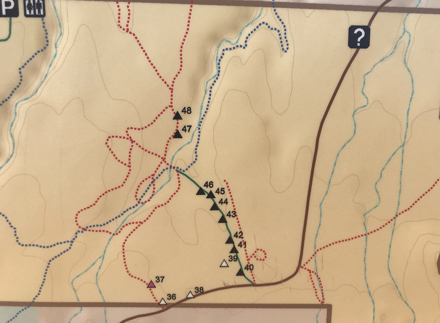
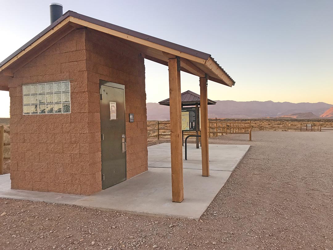
There are toilets at the Sheepbridge Trailhead halfway between Rte 9 and Rte 59 as shown on this map:
Verizon has very good LTE service at these campsites.
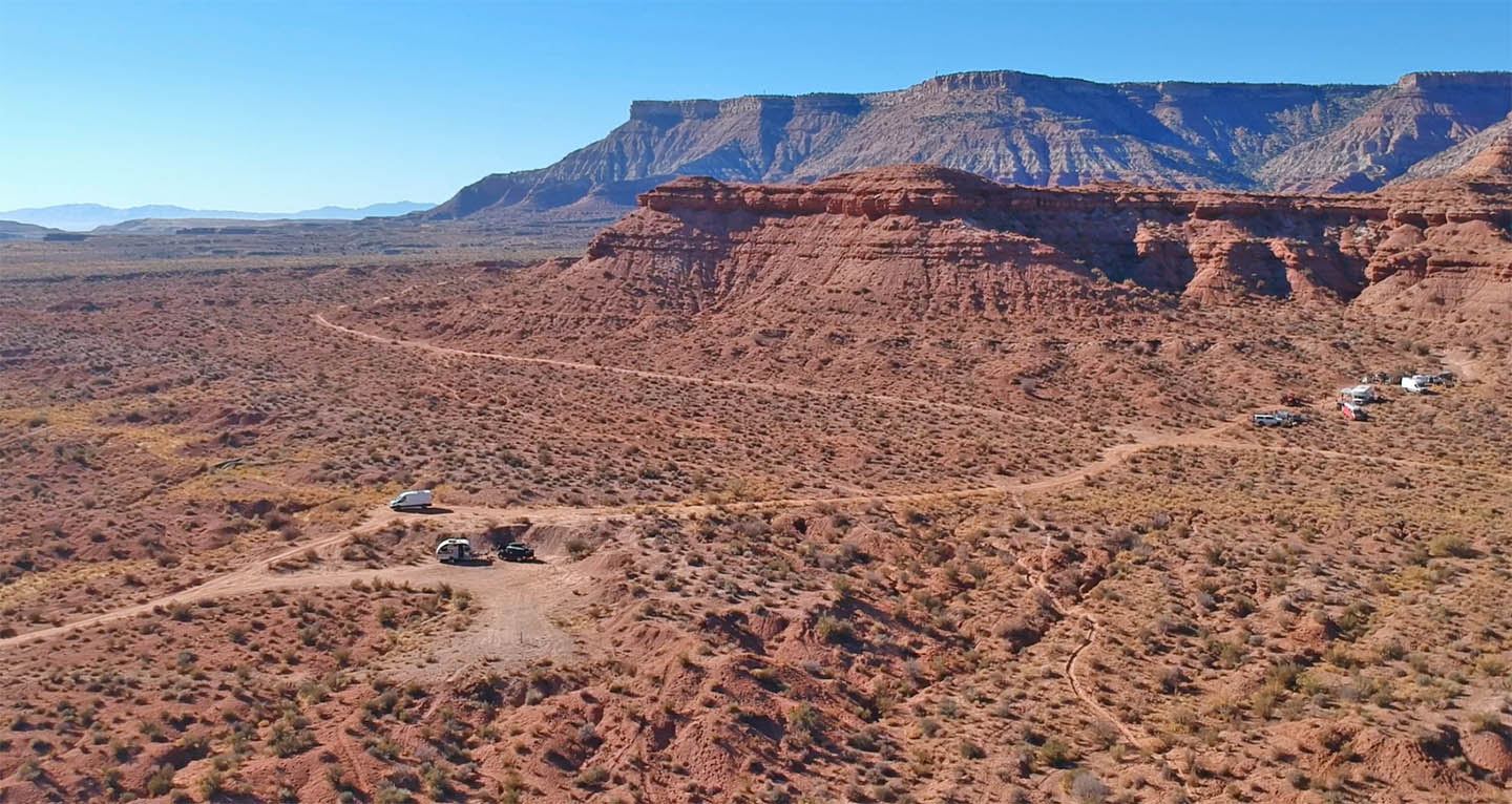
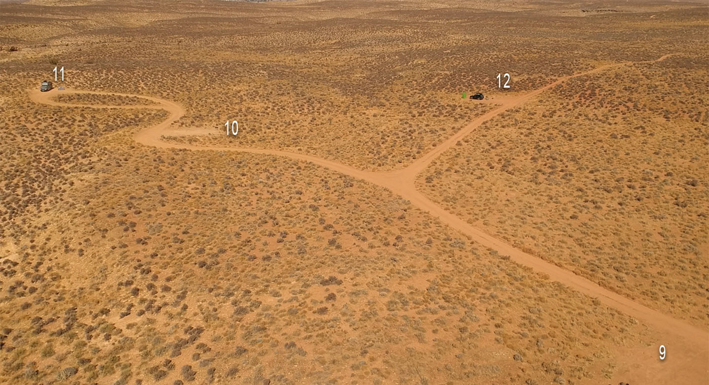
Free Camping in the Hurricane Cliffs (Sheep Bridge Rd) South Area
Many will say this area is too far from Zion (4.25 miles to SR 9) and I agree but the sites are far apart and with easy access to SR 59 (0.65 miles) and the city of Hurricane.
The information board is at the entrance to Sheep Bridge Rd after the turn from SR 59. Please stop to read the rules and look at the camping maps.
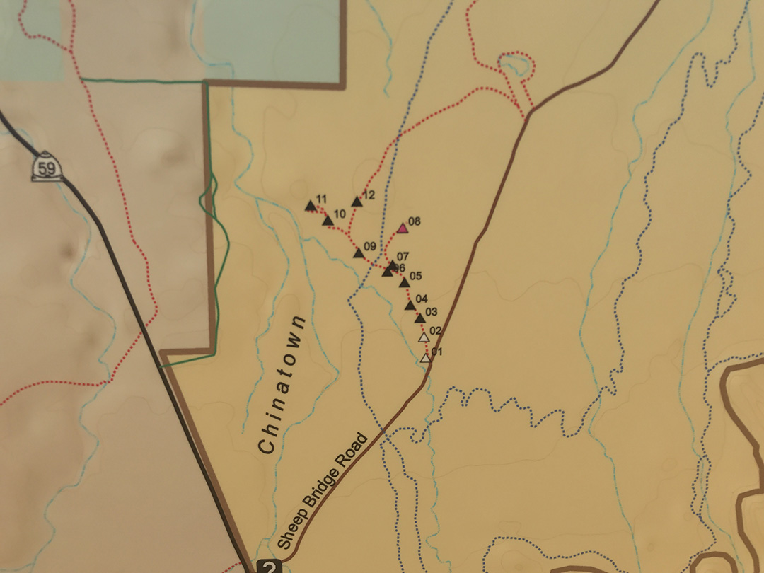
After only 0.65 miles of washboard dirt road, turn left into the designated camping area.
About potable water and toilets – as shown on the map you can either drive to La Verkin (Maverik fuel with a free dump station) or the first bus stop in Springdale (water). Toilets (see above section).
Verizon has very good LTE service at these campsites.
Free Camping in the Hurricane Cliffs (La Verkin Overlook Rd) Area
This area is perfect if you plan to explore Zion National Park and want to be closer to towns with affordable gas and supplies. The dirt roads are bad but short!
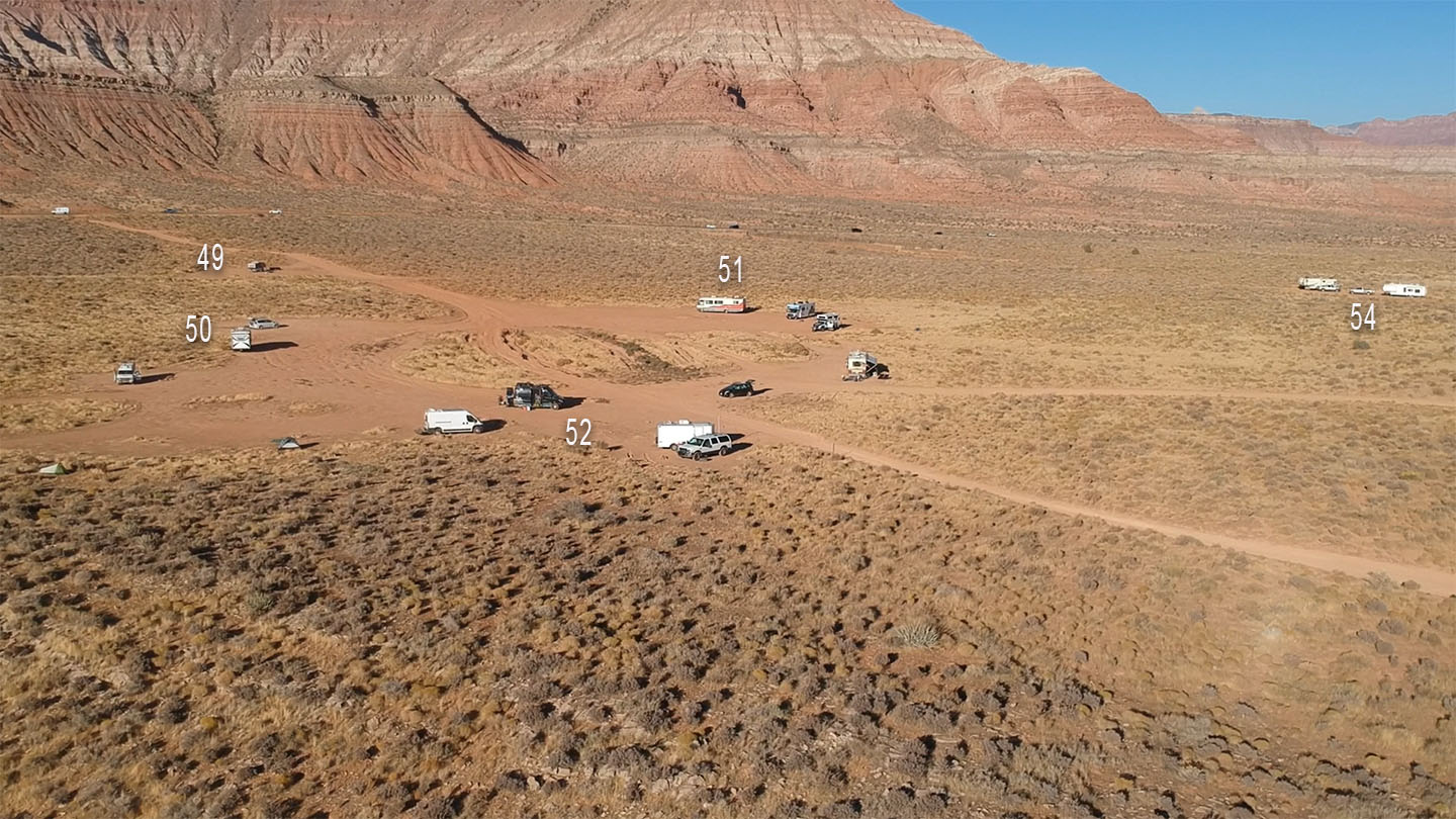
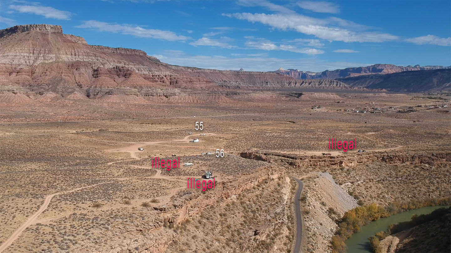
Please camp in designated campsites only – there’s a lot of illegal camping here which ruins the areas closed for regeneration.
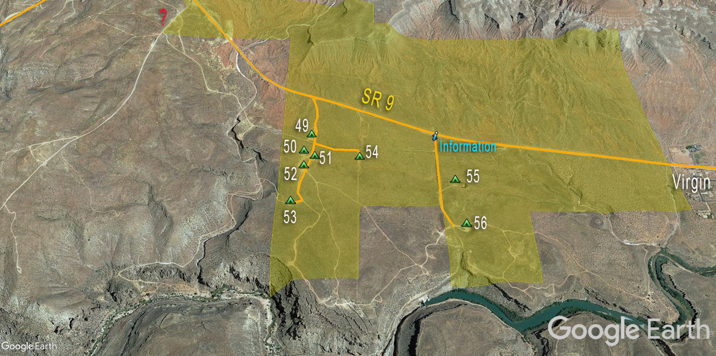
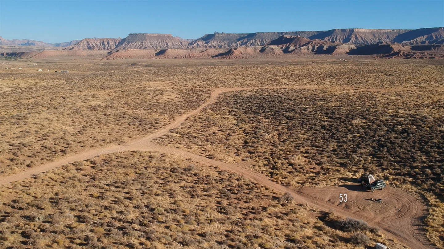
Note the red? in the upper left corner. I see RVs camped there all the time but the location is marginal and not a designated site! Basically on the BLM line so be careful.
Sites 50, 51, and 52 are large and shared by many RVs! Spacing and privacy can be an issue.
About potable water and toilets – as shown on the map you can either drive to La Verkin (Maverik fuel with a free dump station) or the first bus stop in Springdale (water).
Verizon has very good LTE service at these campsites.