Free Camping in Las Cienegas near Sonoita and Tucson, AZ
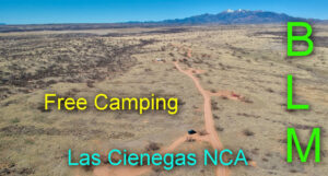
Welcome to our guide for FREE camping on BLM land in Las Cienegas NCA near Sonoita in Arizona. The location is ideal when visiting the wineries near Sonoita and exploring Tucson.
In this guide, we provide maps with directions, updates on road conditions, locations of most campsites, and availability of amenities such as cell coverage, water, and toilets.
Our Experience
Las Cienegas (Empire Ranch0 is a wonderful FREE area for camping in Arizona and we highly recommend the camping and the greater Sonoita wine area. The sites are large and spread out but for the most part, you must camp in a designated site.
Our only concern is the limited designated site availability, especially within 5 miles of the entrance. There are more sites further away, but then the drive to town takes too long.
During busy times, you may have to share a large site! The signs indicate that each site can accommodate two RVs and folks can and will pull in close to you! We had very nice neighbors during a recent stay but you may not be this lucky!
If you can, grab a smaller designated site when you want privacy.
Cell and TV
Our Verizon service worked well and we received over 60 free TV channels!
Water and Sewer
There is a potable spigot (and hose) near the toilets at the Empire Ranch Headquarters with enough room to park a large RV for fillup.
There is a dump station at the Pilot gas station on I-10 but we did not use it.
About the BLM land and Las Cienegas NCA
The Las Cienegas National Conservation Area is under the stewardship of the Bureau of Land Management (BLM) in Tucson, AZ.
The Empire and Cienega ranches, and portions of the adjacent Rose Tree and Vera Earl ranches, are now under public ownership and managed by BLM.
While the area is large, we caution you to know your location and avoid accidental trespassing. The land boundaries are confusing and you must negotiate many cattle fences and State Trust parcels.
We recommend you study the BLM maps before arriving in Tucson and visit the BLM office to learn more about the restrictions, rules, and land boundaries.
Online Map
Online, look at the interactive map – BLM Interactive Recreational, and zoom to the Sonoita area. BLM land and Las Cienegas NCA is shown in yellow.
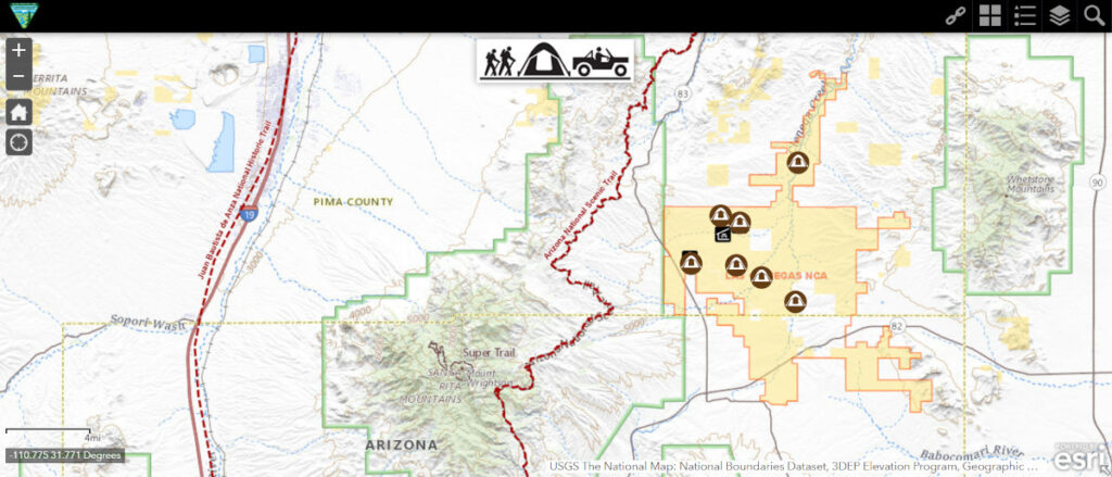
Tucson BLM Field Office
3201 E. Universal Way
Tucson, AZ 85756711
Phone: 520-258-7200
You can buy paper maps for a small fee. The office staff is friendly and helpful.
Maps and Directions
We highly recommend the Avenza Maps App!
Unfortunately, there are no maps for this area and we suggest you use this article for directions.
Las Cienegas NCA is located 45 miles southeast of Tucson, Arizona. From Tucson, drive southeast on Interstate 10 to exit 281. Head south on Arizona Route 83. Near milepost 40, turn east into the paved ranch entrance (East Empire Ranch Road).
Except for the Maternity Well Group Camping area, there is no camping on either side of the road until you reach the Empire Ranch Headquarters.
Continue on Empire Ranch Road until you see a sign for the Empire Ranch Headquarters. The pavement stops at a cattle grid but the unpaved road is in good condition. At the T-junction, you can turn left for camping spots in Oak Tree Canyon or right to camp further south. The sections below will help you decide where to camp!
6 Main BLM Camping Areas
Primitive camping in Las Cienegas NCA is allowed on existing sites only. Camping may not exceed 14 consecutive days. You must camp at least 0.25 miles from cattle and wildlife water holes.
Group camping (with a special permit) is available at the Airstrip and Maternity Well.
There are 4 main camping areas for individuals.
- Oak Tree Canyon (turn left at the T-junction after the Headquarters signs)
- Los Posos Gulch
- Cieneguita Area
- Road Canyon Area
You can see the exact location of these areas and sites on our interactive Google Map shown above.
Area 1 – Oak Tree Canyon
Perhaps lesser known, there are 10 (or so) spots along this 2.6-mile stretch of bumpy dirt road near the airstrip. The sites are not numbered.
Turn left at the T-junction, mentioned above, and cross the shallow Empire Gulch at the 0.7-mile mark. The dip is paved so do not be concerned about the water unless it is flowing hard! Turn left after 0.9 miles onto FR6902 and the sites appear on your right after the sign for Oak Tree Canyon.
Please refer to our map for site locations. The numbers are unofficial – for illustration only!
FR6902 is an easy, steady uphill drive for 1.7 miles where we stopped at a campsite. We did not explore any further.
In good weather, most RVs can make it to these sites but if you have a very large Class A it may be best to camp south at Cieneguita.
Area 2 – Los Posos Gulch
This area has 7 sites close to the Prairie Dog Reintroduction tract. The sites are not numbered.
The first 3 sites (D, E, F on the map below) are close to the busy South Empire Ranch Road but these can handle any size rig. Big rigs can turn around at the Prairie Dog viewing area but should not venture further.
The next two sites (G and H) are large, private, and popular!
The final few sites are small and best suited for vehicles or vans.
When you reach the gate, you are entering State Trust Land and a permit is required for camping. We saw very few suitable sites after the gate.
Area 3 – Cieneguita
Cieneguita, the main camping area at Empire Ranch, has 8 “official” sites and two informal ones. At first glance, the sites look very big and private but sharing sites is expected and you may or may not appreciate your close neighbors! The sites are numbered from 1 to 8.
If you wonder why folks pull into your site, look closely at the information boards nearby! It states that “each site can hold up to 2 RVs”!
If you arrive first, we recommend parking in a corner of the site to allow for some space between your rig and a newcomer. If you park in the middle of the site, newcomers are forced to park close to you!
Large rigs can check all the sites and turn around just before the gate. Do not drive further unless you are sure one of the 3 sites beyond the gate is available.
Site 8 is just on the other side of the gate (please keep it closed) and there are two more informal sites a short distance further down the road.
Cattle roam the Las Cienegas NCA so please be mindful of water troughs and feeding stations should you camp elsewhere away from the designated camp areas. Keep a distance of 1/4 mile.
Area 4 – Road Canyon Area
This area is too far from the Las Cienegas NCA entrance for our liking so we did not camp there but it will work when nothing else is available. The sites are shown on our map above.

