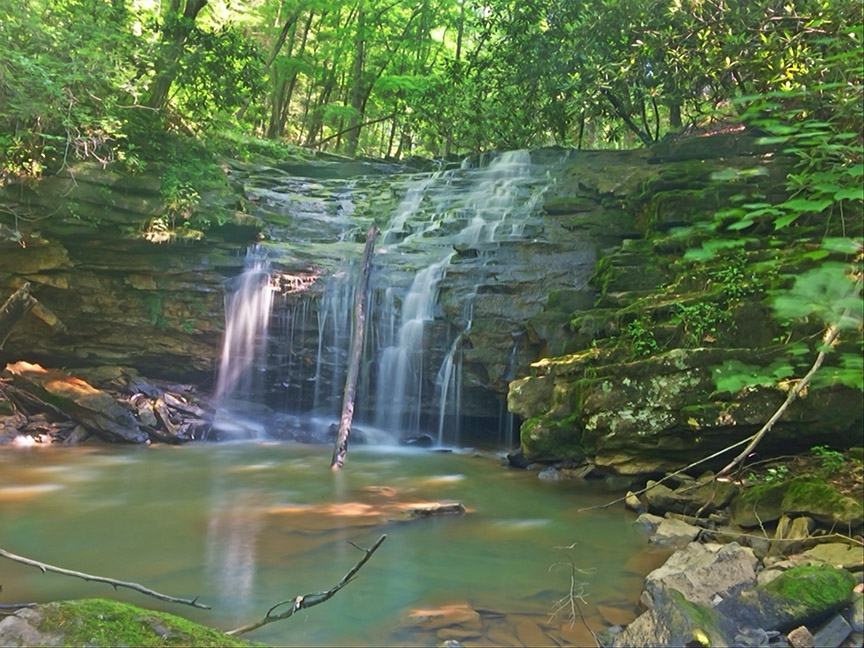
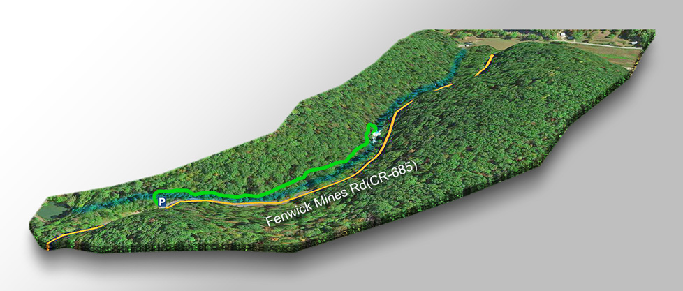
Fenwick Mines is a beautiful waterfall and swimming hole just 0.3 miles from the parking area along Fenwick Mines Road (CR-685).
It is located in an old mining area and today there are hiking trails and picnic facilities.
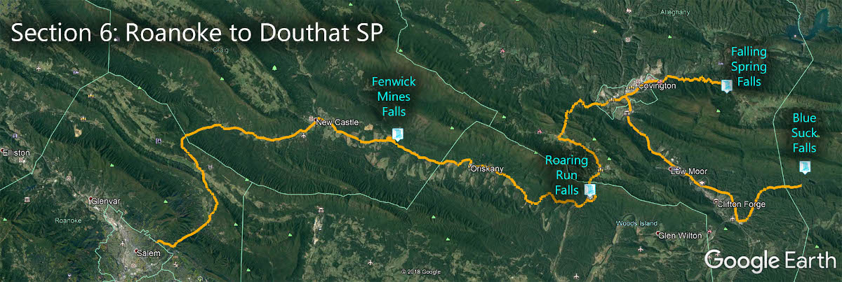
The Great Virginia Waterfall Trail
Fenwick Mines Falls is in Section 6 of the Great Virginia Waterfall Trail which travels 115 miles from Roanoke to Douthat State Park Gap.
Directions
Follow Market Street/Craigs Creek Road north out of New Castle for about 5 miles then turn onto State Route 611. Soon afterwards turn right onto Fenwick Mines Rd and the parking area will be on the right after just over a mile.
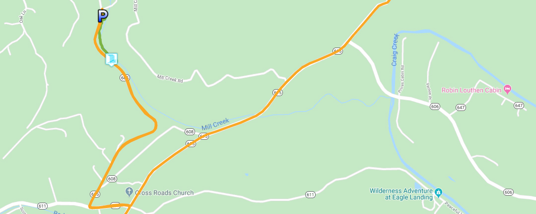
Trail Map
The Trail
The short and flat trail to Fenwick Mines Waterfall is well-maintained and wheelchair accessible (up to the overlook). There is an easy but narrow trail down to the base of the Falls (highly recommended).
Walk over the footbridge then turn right and the Falls will be 0.3 miles away!
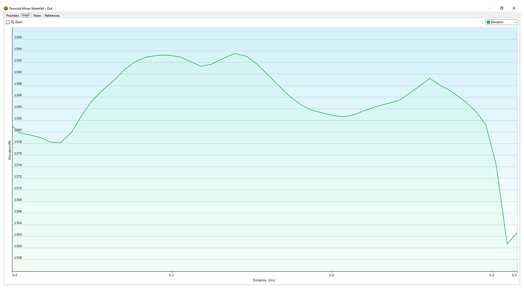
Trail Profile
Google Map of Virginia Waterfalls
Fenwick Mine Falls is near New Castle on this Virginia Waterfalls map by Eben Schoeman.