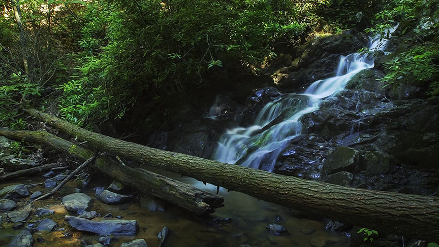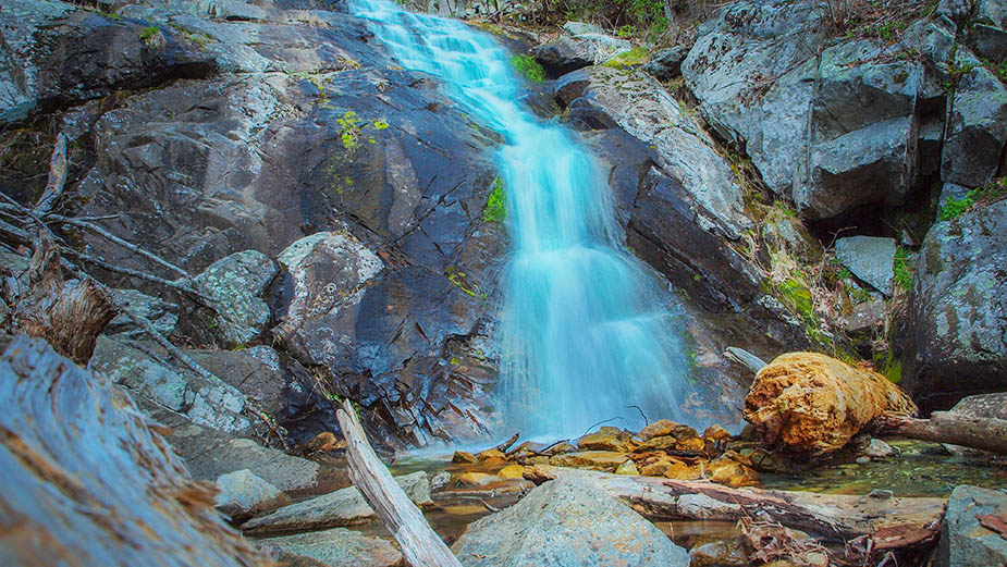
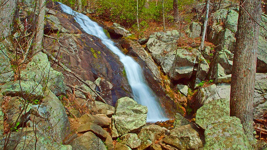
Fallingwater Cascades is one of the epic waterfall hikes along the Blue Ridge Parkway in Virginia.
With a well-marked trail and an option to do a loop hike, this is one of our favorite short getaways. After the hike, you can continue to hike up Flat Top Mountain or you can drive around the corner to relax at the Peaks of Otter!
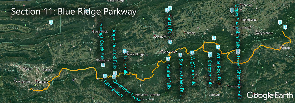
The Great Virginia Waterfall Trail
Fallingwater Cascades is in Section 11 of the Great Virginia Waterfall Trail which travels 170 of the Blue Ridge Parkway.
Directions
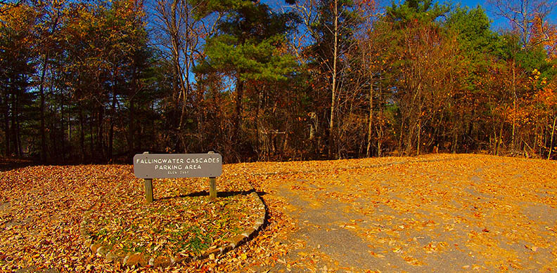
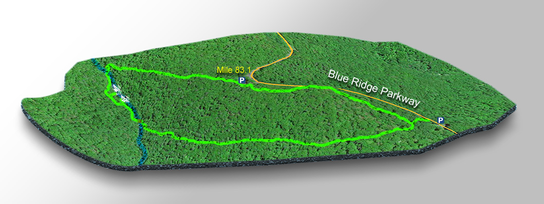
In the Peaks of Otter area at mile 83.1 park in the large Fallingwater Cascade lot then walk left to pick up the trail.

Trail Map
The Trail
You can also follow the crowds to the right but we much prefer the clockwise loop hike; approaching waterfalls from the base and then following it upstream – this is our thing!
The loop hike is 1.35 miles. You can do a shorter hike if you go right down to the first cascade and back.
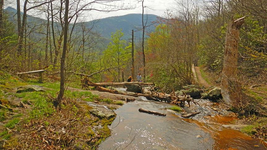
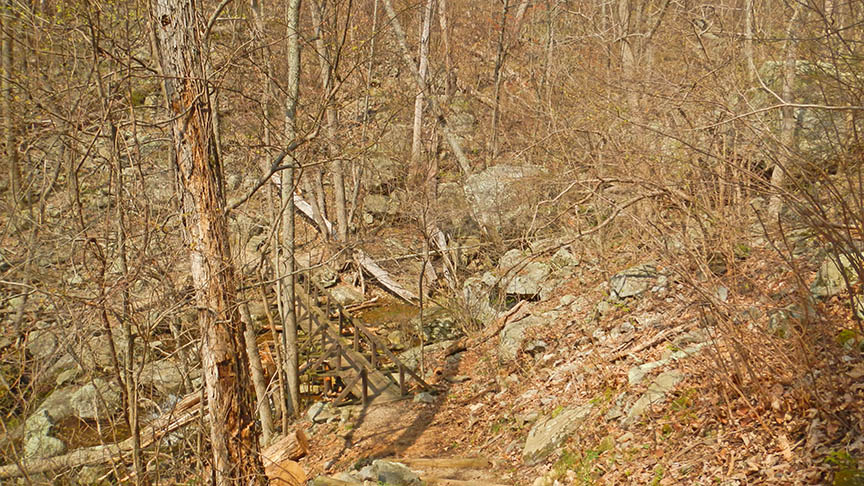
The trail is well-maintained but it gets steep around the cascades as can be expected. At the base of the Cascades is a bridge so you will not get your feet wet when crossing!
On the map, you see a second parking area. This is the trailhead for Flat Top Mountain. If you plan to also hike to the summit we suggest you park here then hike down to the Cascades and loop back (clockwise).
Google Map of Virginia Waterfalls
Fallingwater Cascades is along the Blue Ridge Parkway on this Virginia Waterfalls map by Eben Schoeman.