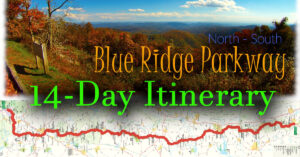
14-Day Itinerary Introduction
In 2 weeks on the road, you can truly experience the best of the Blue Ridge Parkway especially if you enjoy hiking. You can also explore several nearby towns and attractions such as Lexington, Roanoke, Floyd, Blowing Rock, Grandfather Mountain, Asheville, Chimney Rock, and Cherokee.
For this reason, I highly recommend this itinerary.
Please Note: This Itinerary assumes you want to drive the WHOLE Parkway, not shorter sections.
Day 1 – Waynesboro to Lexington
On Day 1 we travel from Waynesboro in Virginia (BRP Mile 0) to an exit at Mile 45.6, and on to Historic Lexington!
Click here to see today’s Route in 3D Motion!
Highlights
- The views from the summit of Humpback Rocks
- Several overlook vistas
- The very tall Crabtree Falls

Day 1 Itinerary
Please click on each activity for tips, maps, pictures, and descriptions.
| Mile | Arrive | Activity | Time |
| 0.0 | 8:00 am | Start of Parkway – Rockfish Gap | 5 mins |
| 5.8 | 8:15 am | Humpback Rocks Visitor Center Restrooms Walk – Farmstead HIKE – Humpback Rocks | 2h15m |
| 8.8 | 10:35 am | Greenstone Overlook Walk – short exhibit trail | 20 mins |
| 10.4 | 11:00 am | Rock Point Overlook | 5 mins |
| 10.7 | 11:06 am | Raven’s Roost Overlook | 5 mins |
| 19.0 | 11:30 am | 20-minute Cliff Overlook | 5 mins |
| 27.2 | 11:50 am | Exit 56 east to Montebello then 15 mins to the Falls Restrooms Picnic lunch HIKE – Crabtree Falls | 2h0m |
| 34.4 | 2:15 pm | Yankee Horse Ridge Viewpoint HIKE – Rail tracks / Wigwam Falls | 20 mins |
| 45.6 | 3:00 pm | Exit 60 west to Lexington (10 miles) Lexington Visitor Center | |
| Overnight in Lexington |
Google Map – Mile 0 to Mile 45.6
Day 2 – Explore Lexington, VA
On Day 2, we explore historic Lexington and nearby attractions.
Highlights
- Walk historic Lexington
- Natural Bridge State Park
- Goshen Pass Scenic Drive

Day 2 Itinerary
Please click on the link below for tips, maps, pictures, and descriptions.
| Mile | Arrive | Activity | Time |
| A Perfect Day in Lexington, VA | |||
| Overnight in Lexington |
Day 3 – Lexington to Peaks of Otter
On Day 3 we travel from Lexington to the popular Peaks of Otter Lodge!
Click here to see today’s Route in 3D Motion!
Highlights
- James River and its historic canal system
- Several overlook vistas
- A short walk along the Appalachian Trail
- Two very popular waterfalls
- National D-Day Memorial
- Historic Peaks of Otter Lodge

Day 3 Itinerary
Please click on each activity for tips, maps, pictures, and descriptions.
| Mile | Arrive | Activity | Time |
| 45.6 | 8:00 am | Start | |
| 63.1 | 8:25 am | Otter Lake | 5 mins |
| 63.6 | 8:35 am | James River Visitor Center Walk the Canal Exhibit HIKE – Trail of the Trees Restrooms | 1 hour |
| 74.7 | 9:55 am | Thunder Ridge Overlook | 5 mins |
| 75.2 | 10:10 am | Arnold Valley Overlook | 5 mins |
| 78.4 | 10:20 am | Sunset Field Overlook HIKE – Apple Orchard Falls Trail | 2 hours |
| 83.1 | 12:30 pm | Falling Water Cascades Overlook HIKE – Falling Water Cascades Trail | 1h 30 mins |
| 85.6 | 2:05 pm | Peaks of Otter Lodge Lunch | 55 mins |
| 3:00 pm | Peaks of Otter Visitor Center Gather trail information | 20 mins | |
| 3:20 pm | Drive to Bedford (25 min drive, must arrive by 4:30 pm) National D-Day Memorial | 1h 50 mins | |
| Overnight Peaks of Otter Lodge |
Google Map – Mile 45.6 to Mile 85.6
Day 4 – Peaks of Otter to Roanoke
On Day 4 we travel from the Peaks of Otter to sprawling Roanoke – The Star City of the South!
Highlights
- Hike to the summit of Sharp Top Mountain
- Several overlook vistas
- Explore Park near Roanoke
- Sunset views of Roanoke from Mill Mountain
- Walk Downtown Roanoke

Day 4 Itinerary
Please click on each activity for tips, maps, pictures, and descriptions.
| Mile | Arrive | Activity | Time |
| 85.6 | 8:00 am | Start | |
| 85.9 | 8:15 am | HIKE – Sharp Top Trail Restrooms | 2 hours |
| 92.1 | 10:30 am | Purgatory Mountain Overlook | 5 mins |
| 95.2 | 10:40 am | Pine Tree Overlook | 5 mins |
| 95.3 | 10:50 am | Harvey’s Knob Overlook | 5 mins |
| 99.6 | 11:05 am | Great Valley Overlook | 5 mins |
| 115.0 | 11:40 pm | Explore Park Blue Ridge Parkway Visitor Center Restrooms | 20 mins |
| 120.4 | 12:15 pm | Exit west on Mill Mountain Parkway Roanoke Visitor Center O. Winston Link Museum Restrooms Lunch | 2 h 45 mins |
| 3:00 pm | VA Museum of Transportation Restrooms | 1 hour | |
| 4:30 pm | Walk – Market Square Downtown Shops, Restaurants, and Bars | ||
| Sunset | Mill Mountain – Roanoke Star Restrooms | ||
| Overnight Roanoke |
Google Map – Mile 85.6 to Mile 120.4
Day 5 – Roanoke to Floyd and Galax
On Day 5 we travel from Roanoke in Virginia to Galax – Gateway to the Blue Ridge Mountains!
Highlights
- Rock Castle Gorge Vistas
- Wine tasting at two of Virginia’s best wineries
- Photogenic Mabry Mill
- Visit a candy factory
- Blue Ridge Music Center
- Mountain music in Galax and Floyd

Day 5 Itinerary
Please click on each activity for tips, maps, pictures, and descriptions.
| Mile | Arrive | Activity | Time |
| 120.4 | 9:00 am | Early AM (Check wineries and Blue Ridge Music Center for opening hours and live events – then plan accordingly). See below Start | |
| 139.0 | 9:30 am | Cahas Mountain Overlook | 5 mins |
| 143.9 | 9:45 am | Devil’s Backbone Viewpoint | 5 mins |
| 168.0 | 10:25 am | The Saddle Overlook | 5 mins |
| 168.8 | 10:35 am | Rock Castle Gorge Overlook | 5 mins |
| 169.0 | 10:45 pm | Rocky Knob Visitor Center Restrooms | 10 mins |
| 170.4 | 11:00 am | Winery – Villa Appalaccia (check opening hours) Restrooms | 30 mins |
| 171.8 | 11:35 am | Winery – Chateau Morrisette (check opening hours) Restrooms Lunch here or at Mabry Mill | 1h 15 mins |
| 176.2 | 1:00 pm | Mabry Mill Lunch (if not Morrisette) Walk – Exhibits Restrooms | 45 mins |
| 177.7 | 2:00 pm | Exit US58 to Meadows of Dan Nancy’s Candy Co. Walk – Short stroll to see other Stores | 30 mins |
| 189.9 | 2:45 pm | Puckett Cabin | 5 mins |
| 213.3 | 3:25 pm | Blue Ridge Music Center (check music schedule) Restrooms | 30 mins |
| 215.8 | 4:00 pm | Exit Route 89 West Overnight Galax (or Floyd) |
Google Map – Mile 120.4 to Mile 215.8
Day 6 – Galax, VA to Blowing Rock, NC
On Day 6 we travel from Galax in Virginia to Blowing Rock in North Carolina.
Highlights
- Several magnificent vistas
- A historic farm cabin
- Waterfall hike
- Wine tasting
- Afternoon and evening at leisure in Blowing Rock – one of North Carolina’s most popular mountain towns

Day 6 Itinerary
Please click on each activity for tips, maps, pictures, and descriptions.
| Mile | Arrive | Activity | Time |
| 215.8 | 9:30 am | Early AM – Check The Bluffs restaurant opening hours (link below) and plan your day accordingly if you want to have breakfast or lunch there. Otherwise, pack a lunch box! Start | |
| 217.5 | 9:35 am | Cumberland Knob Restrooms | 5 mins |
| 218.6 | 9:45 am | Fox Hunter’s Paradise Viewpoint | 10 mins |
| 232.5 | 10:15 am | Stone Mountain Overlook | 5 mins |
| 238.5 | 10:30 am | Brinegar Cabin | 30 mins |
| 241.0 | 11:05 am | The Bluffs Restaurant (opening hours vary daily – check the day before!) Lunch (if open) Visitor Center and Park Store | 30 mins |
| 243.4 | 11:40 am | Bluff Mountain Viewpoint | 5 mins |
| 258.7 | 12:05 pm | Winery – Thistle Meadow Freeborne’s Restaurant may be open If you want lunch, or eat your packed lunch at the winery Restrooms | 30 mins |
| 271.9 | 12:55 pm | HIKE – Cascade Waterfalls Restrooms | 1 hour |
| 281.4 | 2:10 pm | Grand View Overlook | 5 mins |
| 289.8 | 2:25 pm | Yadkin Valley Overlook | 5 mins |
| 290.4 | 2:35 pm | Thunder Hill Overlook | 5 mins |
| 291.8 | 2:45 pm | Exit Route 221 | |
| Overnight in Blowing Rock or Boone |
Google Map – Mile 215.8 to Mile 291.8
Day 7 – Explore Blowing Rock and Linville
On Day 7 we explore the many attractions in and near Blowing Rock and Linville.
Highlights
- Sunrise at the famous Linn Cove Viaduct
- Hike scenic trails
- Linville caverns
- Wine tasting
- Another evening at leisure in Blowing Rock

Day 7 Itinerary
Please click on each activity for tips, maps, pictures, and descriptions.
| Mile | Arrive | Activity | Time |
| 291.8 | 6:30 am | Start early to reach the Viaduct before sunrise | |
| 302.8 | 6:50 am | Rough Ridge Parking HIKE – Viaduct Viewpoint at sunrise | 1 hour |
| 303.9 | 7:55 am | Park at Yonahlossee Overlook then walk Classic early AM Viaduct photo! | 30 mins |
| 305.1 | 8:45 am | Exit Route 221 west Breakfast in Linville – Tartan Restaurant | 1h 30 mins |
| 305.2 | 10:45 am | HIKE – Beacon Heights Trail | 1 hour |
| 308.5 | noon | HIKE – Flat Rocks Trail | 1 hour |
| 317.4 | 1:15 pm | Tour – Linville Caverns | 40 mins |
| 2:00 pm | Lunch – Louise’s Rock House Restaurant | 45 mins | |
| 3:00 pm | Winery – Linville Falls | 30 mins | |
| 304.4 | 3:45 pm | Linn Cove Visitor Center (if open) Walk – Viaduct Restrooms | 20 mins |
| 296.7 | 4:15 pm | Price Lake | 5 mins |
| 294.6 | 4:25 pm | Cone Manor House Restrooms | 30 mins |
| 291.8 | 5:05 pm | Exit Route 221 Overnight in Blowing Rock |
Google Map – Mile 291.8 to Mile 317.4 and back
Day 8 – Grandfather Mountain
On Day 8 we explore the many attractions on Grandfather Mountain before traveling to Linville where we overnight.
Highlights
- Another opportunity to film the famous Linn Cove Viaduct at sunrise
- Hike very scenic trails on Grandfather Mountain
- The famous Swing Bridge
- See bears, cougars, and more!
- If time permits, another Wine Tasting
- Evening at leisure in the Linville area

Day 8 Itinerary
Please click on each activity for tips, maps, pictures, and descriptions.
| Mile | Arrive | Activity | Time |
| 291.8 | 7:20 am | Please Plan and Book your Grandfather Mountain tickets ONLINE ONLY Start | |
| 305.1 | 7:45 am | Exit Route 221 west | |
| 8:00 am | Grandfather Mountain Walk – Swing Bridge HIKE – MacRea & Calloway Peaks HIKE – Bridge Trail to the parking area Lunch – Nature Museum Wildlife Habitats Restrooms | 9 hours | |
| Winery – Grandfather Vineyard and Winery (If time permits) | |||
| Overnight Linville |
Google Map – Mile 291.8 to Mile 305.1 and back
Day 9 – Linville to Little Switzerland
On Day 9 we travel from Linville in North Carolina to scenic Little Switzerland with an afternoon hike to another beautiful waterfall!
Highlights
- Hike two of North Carolina’s top waterfalls
- Several very scenic overlooks
- Visit a Minerals Museum and perhaps mine for precious stones
- Overnight in a scenic mountain village

Day 9 Itinerary
Please click on each activity for tips, maps, pictures, and descriptions.
| Mile | Arrive | Activity | Time |
| 305.1 | 9:00 am | Start | |
| 316.4 | 9:30 am | Linville Falls Visitor Center HIKE – Linville Falls Trail Restrooms | 1h 30 mins |
| 320.8 | 11:20 am | Chestoa Viewpoint | 10 mins |
| 323.0 | 11:40 am | Bear Den Overlook | 5 mins |
| 328.3 | 11:55 am | Visit – Orchard at Altapass Lunch | 45 mins |
| 328.6 | 12:45 pm | The Loops Viewpoint | 5 mins |
| 330.9 | 12:55 pm | Minerals Museum | 20 mins |
| 333.9 | 1:20 pm | Little Switzerland Inn (Perhaps an Early Check-In!) | 20 mins |
| 338.8 | 1:50 pm | Three Knobs Viewpoint | 5 mins |
| 339.5 | 2:00 pm | HIKE – Crabtree Falls Trail Restrooms | 2 hours |
| 333.9 | 4:10 pm | Back to Little Switzerland Explore Little Switzerland Village or Spruce Pine If you prefer more walking, there is a 0.8-mile trail to Grassy Creek Falls as shown on my map Overnight Little Switzerland Inn |
Google Map – Mile 305.1 to Mile 333.9
Day 10 – Little Switzerland to Asheville
On Day 10 we travel from Little Switzerland in North Carolina to popular and bustling Asheville.
Highlights
- Several very scenic overlooks
- Walk to the summit of Mt. Mitchell
- Hike to a viewpoint with stunning views of Craggy Gardens
- Visit a Craft Museum and the Blue Ridge Parkway’s main Visitor Center
- Overnight in romantic Asheville

Day 10 Itinerary
Please click on each activity for tips, maps, pictures, and descriptions.
| Mile | Arrive | Activity | Time |
| 333.9 | 9:00 am | Start | |
| 342.2 | 9:20 am | Black Mountains Overlook | 5 mins |
| 347.6 | 9:35 am | Big Laurel Gap (Hewat) Overlook | 5 mins |
| 349.2 | 9:45 am | Laurel Knob Overlook | 5 mins |
| 349.9 | 9:55 am | Mount Mitchell Overlook | 5 mins |
| 355.3 | 10:10 am | Ridge Junction Overlook | 5 mins |
| 355.3 | 10:20 am | Drive – Mount Mitchell Visitor Center Summit Walk Restrooms Lunch | 2h 30 mins |
| 361.2 | 1:10 pm | Glassmine Falls Overlook | 10 mins |
| 363.4 | 1:25 pm | Greybeard Mountain Overlook | 5 mins |
| 364.1 | 1:35 pm | Craggy Pinnacle Parking HIKE – Craggy Pinnacle Trail | 45 mins |
| 364.5 | 2:20 pm | Craggy Gardens Visitor Center Restrooms | 15 mins |
| 382.0 | 3:00 pm | Folk Art Center Restrooms | 30 mins |
| 384.1 | 3:40 pm | Visitor Center Restrooms | 20 mins |
| 384.7 | 4:05 pm | Exit – US240 West Overnight Ashville |
Google Map – Mile 333.9 to Mile 384.7
Day 11 – Explore Asheville
On Day 11 we explore the many attractions in and near Asheville.
Highlights
- Biltmore Estate and Biltmore Village
- Explore the Grove Arcade
- Unique shops along Wall Street

Day 11 Itinerary
Please click on each activity for tips, maps, pictures, and descriptions.
| Mile | Arrive | Activity | Time |
| Explore Asheville | |||
Day 12 – Chimney Rock SP to Mount Pisgah
On Day 12 we travel from Asheville and Chimney Rock State Park to the top of Mount Pisgah.
Highlights
- Chimney Rock State Park
- Explore quaint Chimney Rock Village
- Historic Mt Pisgah Inn

Day 12 Itinerary
Please click on each activity for tips, maps, pictures, and descriptions.
| Mile | Arrive | Activity | Time |
| Depart Asheville no later than 8:30 am | |||
| 9:00 am | Chimney Rock State Park (40 min drive) Lunch Restrooms | 5 hours | |
| Make time to explore the quaint town of Chimney Rock Winery – Burntshirt Vineyards | 1 hour | ||
| 384.7 | 4:00 pm | Start – Blue Ridge Parkway | |
| 399.1 | 4:20 pm | Pine Mountain Tunnel – longest! | |
| 404.4 | 4:30 pm | Mills River Valley Overlook | 5 mins |
| 408.6 | 4:45 pm | Pisgah Inn Overnight Pisgah Inn |
Google Map – Chimney Rock Drive and Hikes
Google Map – Mile 384.7 to Mile 408.6
Day 13 – Mount Pisgah to Cherokee
On Day 13 we travel from Mount Pisgah to Cherokee – the gateway to The Great Smoky Mountains.
Highlights
- Several grand vistas
- Hikes to several waterfalls
- Hikes to mountain viewpoints

Day 13 Itinerary
Please click on each activity for tips, maps, pictures, and descriptions.
| Mile | Arrive | Activity | Time |
| 408.6 | 8:00 am | Start | |
| 409.2 | 8:05 am | Funnel Top Viewpoint | 5 mins |
| 411.9 | 8:15 am | Cold Mountain Viewpoint Exit – Route 276 South Visit – Sliding Rock HIKE – Looking Glass Falls | 1h 5 mins |
| 417.0 | 9:15 am | Looking Glass Rock Viewpoint BONUS HIKE – 0.4 miles to Skinny Dip Falls | 5 mins |
| 418.8 | 9:25 am | Graveyard Fields HIKE – Graveyard Fields Trail | 1h 45 mins |
| 422.4 | 11:15 am | Devil’s Courthouse Overlook HIKE – Devil’s Courthouse Trail | 45 mins |
| 425.4 | 12:05 am | Rough Butt Bald | 5 mins |
| 430.7 | 12:20 pm | Cowee Mountain Overlook | 5 mins |
| 431.4 | 12:30 pm | Richland Balsam Overlook Highest Point on the Parkway | 10 mins |
| 433.3 | 12:50 pm | Roy Taylor Forest Overlook | 10 mins |
| 438.9 | 1:15 pm | Steestachee Bald Overlook | 5 mins |
| 445.2 | 1:30 pm | Mount Lynn Lowry Overlook | 5 mins |
| 446.7 | 1:40 pm | Woodfin Cascades Overlook Walk – Woodfin Cascades Waterfall (small) | 10 mins |
| 449.0 | 2:00 pm | Fork Ridge Overlook | 5 mins |
| 451.2 | 2:10 pm | Waterrock Knob Overlook Picnic Lunch HIKE – Waterrock Knob Trail Restrooms | 45 mins |
| 452.3 | 3:00 pm | Woolyback Overlook | 5 mins |
| 454.4 | 3:10 pm | Thunderstruck Ridge Overlook | 5 mins |
| 458.9 | 3:25 pm | Lickstone Ridge Overlook | 5 mins |
| 461.9 | 3:35 pm | Big Witch Overlook | 5 mins |
| 469.1 | 3:50 pm | Exit Route 441 East Cherokee |
Google Map – Mile 408.6 to Mile 469.1
Day 14 – Explore Cherokee
On Day 14 we explore the many attractions in and near Cherokee.
Highlights
- Museum of the Cherokee Indian
- Unto These Hills Drama
- Oconaluftee Indian Village
- Great Smoky Mountains National Park
- Waterfalls!

Day 14 Itinerary
Please click on each activity for tips, maps, pictures, and descriptions.
| Mile | Arrive | Activity | Time |
| Explore Cherokee | |||