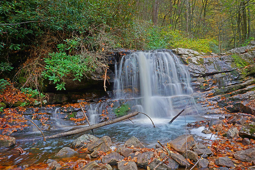
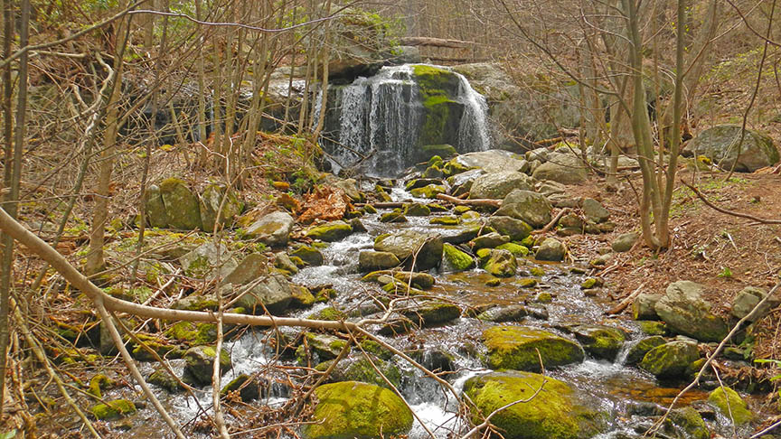
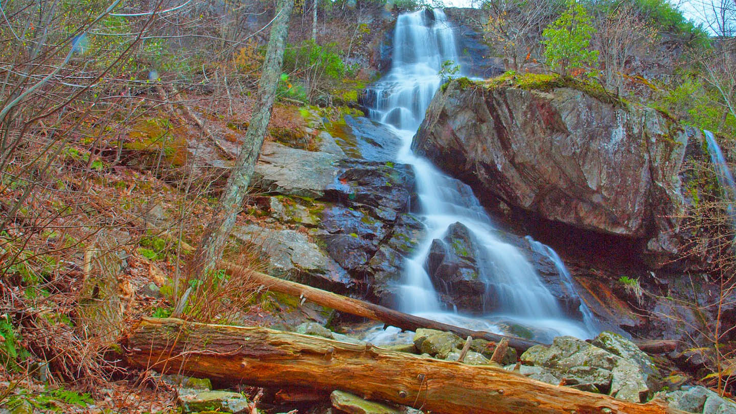
Apple Orchard Falls is one of the more scenic waterfalls along the famous Blue Ridge Parkway in Virginia! Listed at 200 feet it is higher than it looks and well worth the effort especially when the water levels are flowing higher.
Be aware it is a steep 2.7-mile return hike! Give yourself enough time and pack plenty of water.
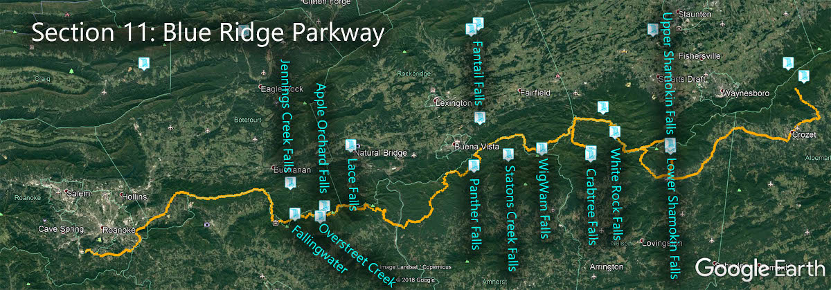
The Great Virginia Waterfall Trail
Apple Orchard Falls is in Section 11 of the Great Virginia Waterfall Trail which travels 170 of the Blue Ridge Parkway.
Directions
There are several ways to reach Apple Orchard Falls. If you have a high-clearance vehicle (4WD preferred) you can park a short distance downstream and hike up. You can also hike up from the North Creek Camping area.
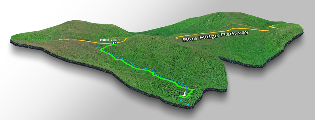
Most folks, however, hike from the Blue Ridge Parkway. Park at mile 78.4 at an overlook called Sunset Field.

Trail Map
The Trail
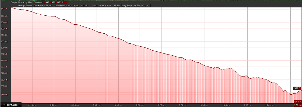
It is a 1.35-mile trail to the Falls and back up for a total of 2.7 miles.
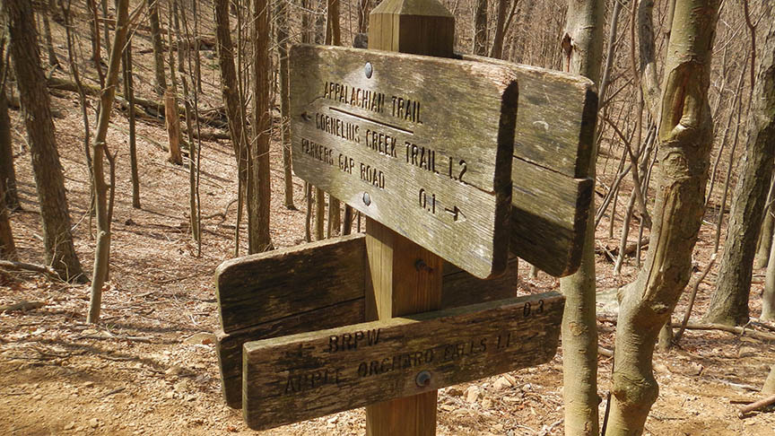
As you hike down, keep an eye on the signs because you will cross other trails including the Appalachian Trail.
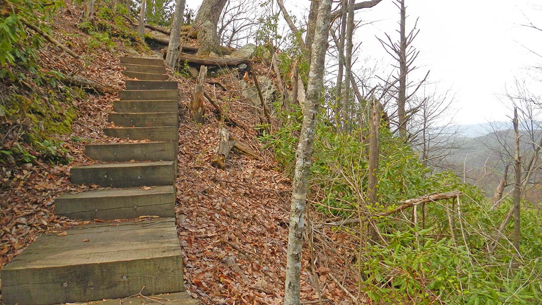
Near the Falls you have to climb down two sets of steep wooden steps.
Trail Profile
Google Map of Virginia Waterfalls
Apple Orchard Falls is along the Blue Ridge Parkway on this Virginia Waterfalls map by Eben Schoeman.