
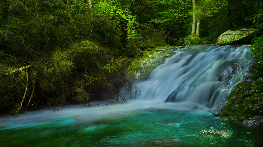
Near the retreat of a former U.S. President (Hoover) is lovely Big Rock Falls.
It is a moderate 1.5-mile hike down to the Falls then another 0.4 miles to Camp Rapidan (the Retreat).
The waterfall trail can be combined with the Laurel Prong Trail and Appalachian Trail for a tough 7.2 loop.
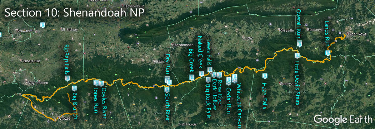
The Great Virginia Waterfall Trail
Big Rock Falls is in Section 10 of the Great Virginia Waterfall Trail which travels the 127 miles of Shenandoah National Park.
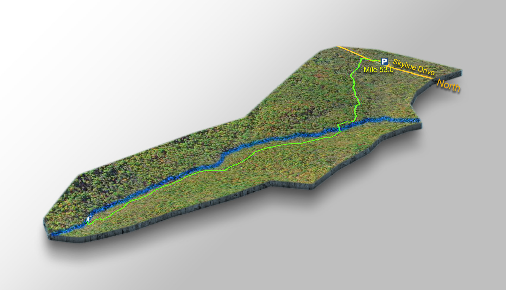
Directions
Park at Milan Gap (Mile 53.0). Then cross Skyline Drive and hike 1.5 miles down the Mill Prong Trail to Big Rock Falls.
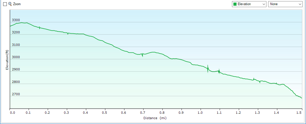
Trail Profile
Google Map of Virginia Waterfalls
Big Rock Falls is in Shenandoah National Park on this Virginia Waterfalls map by Eben Schoeman.