
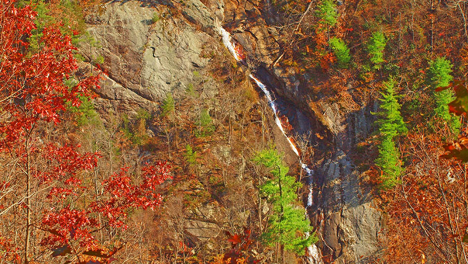
Dropping over 200 feet, Bent Mountain Falls is the 2nd highest waterfall in Virginia!
Located inside the Bottom Creek Gorge Preserve, the Falls are best viewed from an overlook along the Johnston Trail (red markers). When water levels are lower, one could bushwack along Bottom Creek to the foot of the Falls but its true height is obscured.
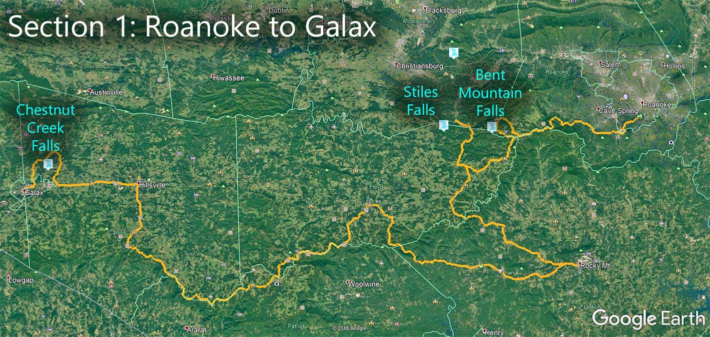
The Great Virginia Waterfall Trail
Bent Mountain Falls is in Section 1 of the Great Virginia Waterfall Trail which travels 182 miles from Roanoke to Galax.
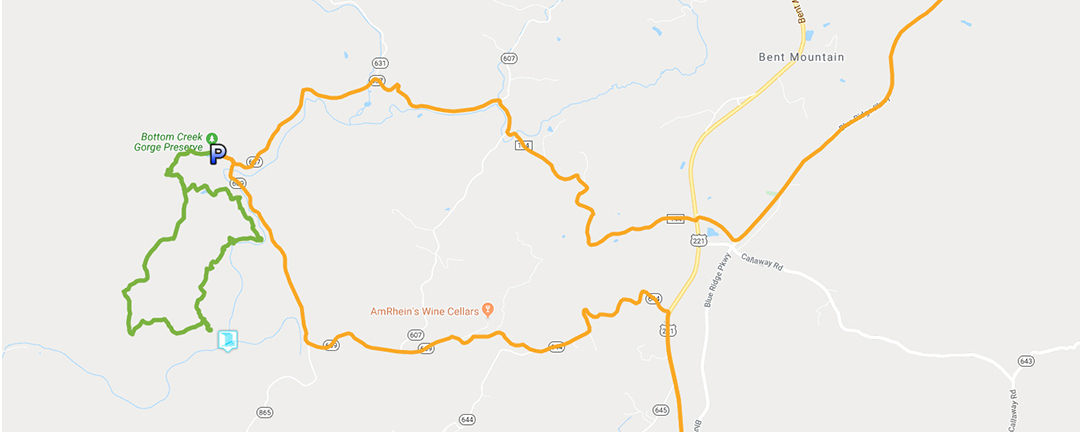
Directions
Make your way to Bottom Creek Lane (SR-637) and look for the bridge where the road crosses Bottom Creek. Turn west on the unpaved road for a short distance until you reach a gate. Do not block the gate when parking!
Please be aware – no dogs are allowed.
Trail Map
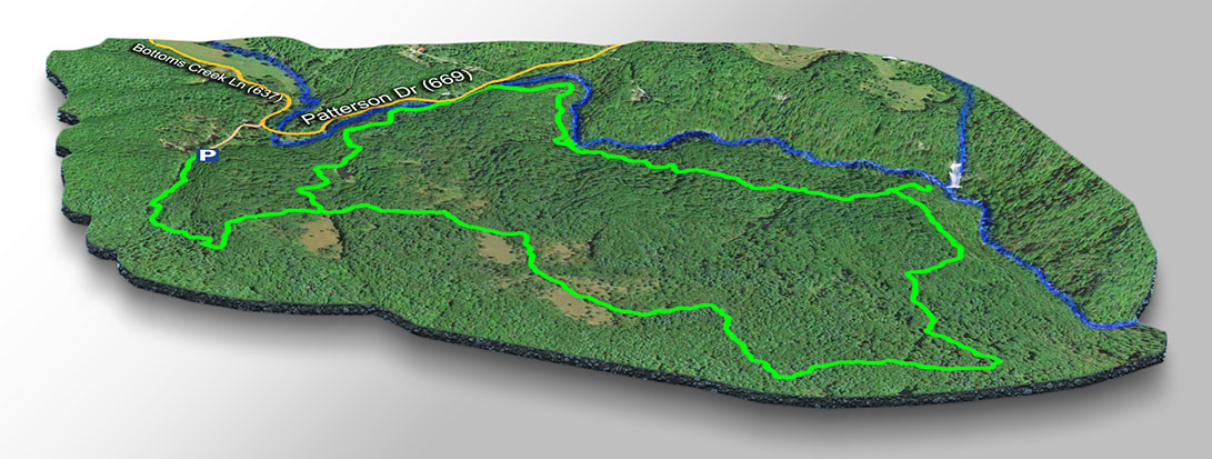
The Trail
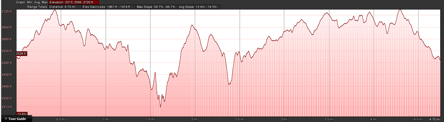
It is a strenuous hike (4.75 miles round-trip but a bit shorter if you stay on the Johnston Trail only) so come prepared. You walk a short distance until you reach the information board where you will be introduced to the three trail options – red, yellow, or blue. We prefer the outer loop (Red – Yellow – Blue) to see the actual Bottom Creek and to see some of the other sights as explained on the information board.

It is 1.6 miles from the parking lot to the Creek and 2.4 miles to the Falls Viewpoint when using the Yellow Trail.
Trail Profile
Google Map of Virginia Waterfalls
Bent Mountain Falls is near Bent Mountain on this Virginia Waterfalls map by Eben Schoeman.